Tucked far away in the northern reaches of Idaho’s Panhandle region lies a paradise of lakes, forests, and mountains where the true boundary of the wilderness presses up against civilization. Spring is a fantastic time to visit this little island of adventure and recreation as the weather begins to warm and the lower-elevation forest roads into the mountains have sufficiently melted out.
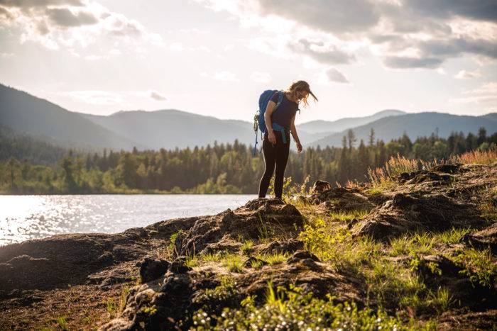
Lying smack-dab in the middle of the area is Priest Lake, an absolute jewel of deep crystal-clear waters, big fish, abundant wildlife, and remote waterfront campgrounds. Named for the Jesuit Priests who were the first European settlers in the area, there is a rich history here as well. Although it’s 19 miles long, only the southern half of the lake is developed, while the northern half remains protected as part of the Idaho Panhandle National Forest. On our now-annual pilgrimage to the Panhandle, we like to get a taste of everything, spending time on the lake, hiking through the northern forests, and skiing and backpacking in the Selkirk Range.

Set up base camp at one of the front-country campgrounds along the lake’s shores: Reeder Bay or Kalispell Bay on the west side, or one of the Priest Lake State Park campgrounds on the east (we prefer Reeder Bay as many of the sites are right on the lake and there is good cell service—a rarity in the area). Several off-grid, or “boondocking” sites line the forest roads branching up from the east shore as well. From camp, launch your boat or rent a kayak or canoe from Elkins Resort, just down the beach from Reeder Bay. On a hot afternoon, a dip in the chilly waters of the lake is the perfect way to cool off and test your grit.

Wildlife viewing is top-notch throughout the region and often begins right after leaving the town of Priest River for the drive along its namesake waterway on the way up to the lake. Deer, moose, and elk are common sights along SR-57, as well as foxes, eagles, hares, and the occasional black bear. One morning, I awoke to the sound of a bald eagle splashing down into the water right in front of my tent. He emerged with a massive Kokanee, which he proceeded to carry to the beach just a few feet away and enjoy. The Priest Lake area is also known for its small population of grizzly bears and mountain caribou (the only such population in the contiguous U.S.), though they rarely come down to the lower lake, preferring to remain in the wilder Upper Priest Lake region near the border with Canada. Even so, sound food storage practices are a must when camping anywhere in the region.
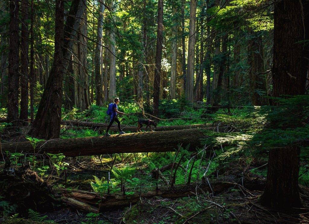
Rising over 7,000 feet from the east shore of the lake are the Selkirk Mountains. This western steppe of the Rockies provides abundant recreational activities in the spring, including hiking, snow-camping, and my favorite, ski touring. Hunt Peak, Gunsight Peak, and Mt. Roothaan are all relatively easy to access via the network of forest service roads that meander into the range, though 4-wheel drive, good directions, and a GPS are highly recommended as many roads are poorly marked and not well maintained at higher elevations.

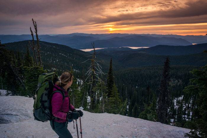
Mt. Roothaan is the perfect place for an easy ski tour with a picturesque camping location in a broad saddle just below the peak. While the snow conditions, tree-falls and washouts may keep you from driving all the way to the trailhead at Horton Lookout, your car can take you almost the entire way up to the 6,000-foot starting point, leaving only a few miles to cover using your own legs. Most of the elevation on the ski-in comes in the last mile as well. After skinning or snowshoeing up the final south face of the mountain, set up your tent in the notch between the western false summit and the true summit a hundred feet above you. From here, watch the sun set over Priest Lake, stargaze at the Milky Way (and often, the Aurora Borealis) throughout the night, and catch a life-list sunrise behind Chimney Rock, a gorgeous monolith just across a steep basin from your camp. An easy ski-out the next day brings you back to your car in time to stop off for lunch or dinner at the Moose Knuckle in nearby Cavanaugh Bay. For more in-depth beta on climbing Mt. Roothaan, or either of its neighboring peaks, Hunt and Gunsight, there are good descriptions here. I’ve also included more accurate directions to the trailhead at Horton Lookout below.
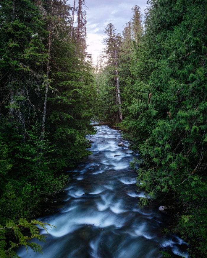
For the truest wilderness experience, however, head up to Upper Priest Lake, via 19 miles of forest roads (which are remarkably well-kept with only minimal washboarding and potholes) and a lush, verdant, four-mile-long footpath. The trail to the lake is reminiscent of the Pacific Northwest coastal rainforest with thickets of waist-high ferns, massive old-growth firs and cedars draped in beard moss, and vivid green foliage as far as the eye can see. Campsites line the lake and wildlife practically bursts from the surrounding forest. Fishing is excellent on the upper lake and hunters often use it as a base camp for their forays into the woods (be sure to wear an orange blaze if hiking during hunting season!) The absence of roads (paved or otherwise) and buildings, along with the specter of the mighty grizzly, makes Upper Priest Lake a veritable Eden for anyone seeking solitude and unbridled wilderness. The Upper Lake is also accessible by boat via a short stretch of river connecting it to the Lower Lake.
The upper panhandle isn’t a huge place, making it the perfect destination for a long weekend of exploring, but it is still so chock-full of incredible scenery and adventures that it could easily keep you entertained for much longer. And its remoteness means you won’t have to share too much with other visitors. Each time we visit, we vow to return, feeling as though we’ve just scratched the surface. And return we will, next spring when the snow melts again and that hot sun beckons us to the water’s edge once more.
Directions to Reeder Bay Campground: From Priest River, ID, follow SR-57 North for 36 miles. Bear right onto Reeder Bay Road and follow it east for about 2 ½ miles. Look for campground signs on the right.
Directions to the Mt. Roothaan Trailhead at Horton Lookout: From Reeder Bay Campground, follow Reeder Bay Road west approximately 2 ½ miles and bear left onto SR-57. Drive south 14 miles and make a left turn onto Dickensheet Highway. Follow Dickensheet Highway 5 ½ miles, make a right turn onto Cavanaugh Bay Road and continue for 3 miles. Stay straight onto E. Shore Dr. and follow it for about 4 ½ miles. Just after you cross a small bridge, Hunt Creek Road (Forest Road 24) bears right up the mountain.
Here, things start to get hairy! Follow FR-24 just over 2 miles to a “T” junction marked with a signpost. Turn right to stay on FR-24. After 1.7 miles, bear left at the fork, following the arrow spray-painted on the tree with the word “chimney.” 1.5 miles further up the road, you’ll reach a four-way intersection. Take a right onto FR-25 and continue for 1.2 more miles where you’ll bear left at another fork in the road (which will look like it’s taking you back downhill.) Finally, after almost a mile, you’ll take a left when the road splits one last time, this time aiming uphill. Continue on the road as far as you can go and park when the snow gets too deep or the blowdowns block your way. This last section may require a 4×4 as rutting and drainages can get pretty deep and rocky. From here, walk, ski, or snowshoe the remainder of the road to a wide-open area with four cement pilings. The trailhead enters the forest on the eastern side of the lot.
The USGS topo maps on www.caltopo.com are also pretty accurate when it comes to existing forest roads, so printing one for the Hunt Creek Road System is a great idea.
Directions from Reeder Bay Campground to Upper Priest Lake Trailhead: Take a left out of the campground and follow Reeder Bay Rd. west for 2 ½ miles. Bear right onto SR-57 for 4 miles. When it turns to gravel, continue straight for about 9 ½ miles on NF-302 to a four-way junction just past Granite Pass. Stay straight as the road becomes NF-1013. Continue on NF-1013 about 8 miles and turn right on NF-655. The trailhead parking is about ¼ mile ahead on the left.
Additional Trip Planning Resources:
- www.caltopo.com is an amazing resource for free topographical maps. I always print the USGS maps before heading out on hikes, climbs, or ski tours, particularly using the slope angle overlays to determine avalanche-prone slopes.
- Even though spring snow conditions on the peaks are generally pretty stable, it’s a good idea to check in with the Idaho Panhandle Avalanche center by calling (866) 489-8664.
- Leave No Trace backcountry ethics are vital to maintaining our wild spaces and ensuring they continue to exist for generations to come. Learn how to Leave No Trace here.
Feature image is credited to Nick Lake.
Original story published June 14, 2016. Updated April 24, 2020.
Nick Lake is a freelance photographer, writer, and videographer living in Seattle, Washington. He loves to tell stories about adventures in the outdoors and you can usually find him in the mountains hiking or skiing with his wife, his son and puppy. Follow along on his adventures on his Website, Instagram, and Facebook.
Published on May 5, 2020
