Steve Graepel worked in partnership with Visit Idaho to create this Travel Tip.
Steaming across the desert pavement, I slowed the truck to read a long litany of warnings: “No gas, repair service, water, or medical…no large campers…dry camping only…recommended high clearance vehicles.”
Idaho’s southwest is a desolate land. Dry, remote and sparsely inhabited; it’s equal parts beautiful and palpably exposed. It feels like the kind of place where a person could simply walk off the earth…like mob man Rico Ponzo did back in 1997, hiding out as a local rancher for nearly a decade from a hit attempt on a Boston mob boss. Or like the three Hawaiian trappers from the Pacific Fur Company did back in 1819, who disappeared altogether exploring for riches in the form of beaver pelts along the aforenamed phonetic Owyhee River.
Nowadays, the County Sheriff still gets called into the Owyhee backcountry to pull out the occasional inattentive weekender. So I heeded the sign and wrenched the wheel, pulling the truck off the highway and aimed the grill due west, up crushed gravel towards Silver City.
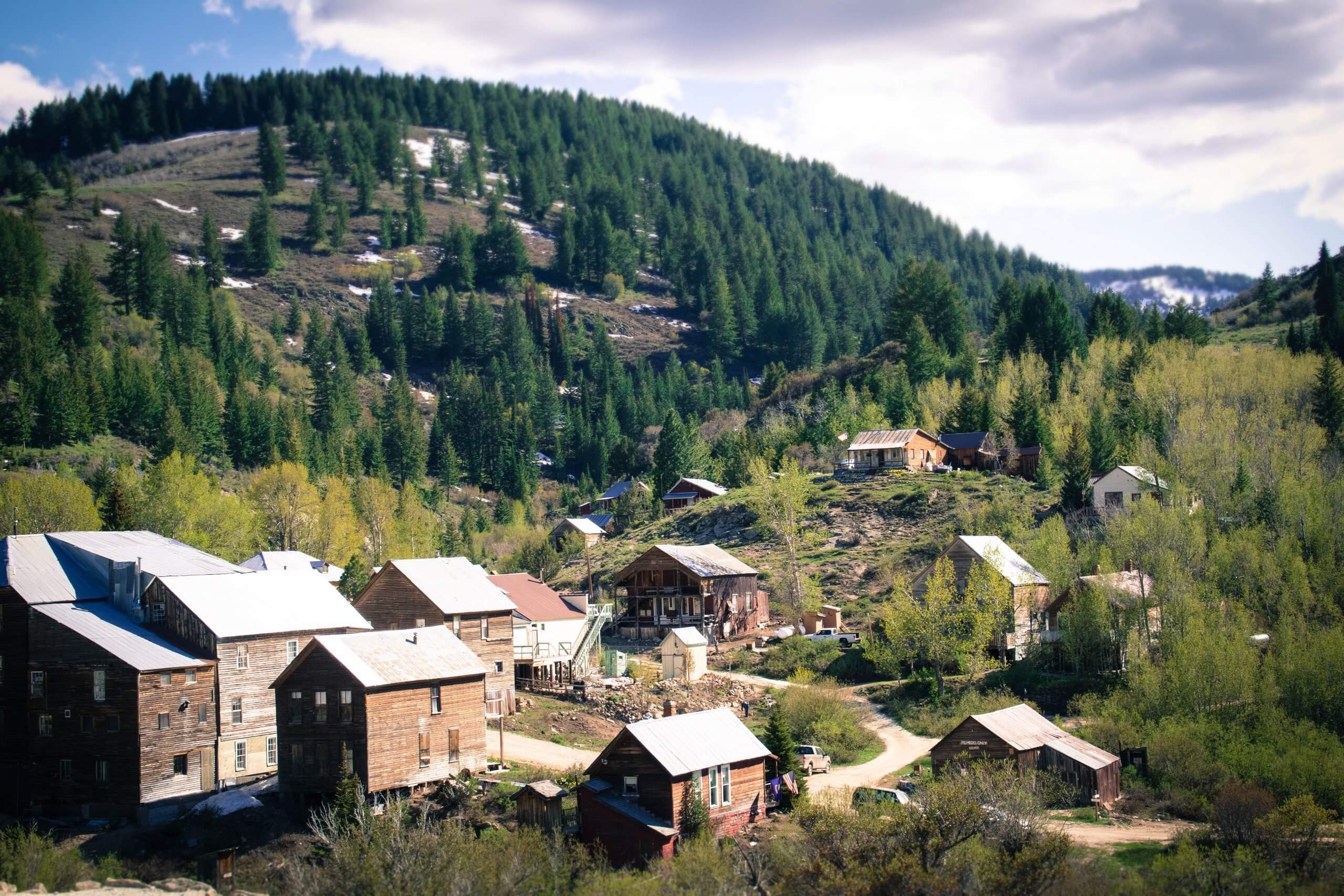
Take a step back in time in Silver City. Photo Credit: Steve Graepel
Take a walk with me back 150 years if you will. While the nation was in the midst of a civil war, 2,500 miles to the west, Silver City was a booming mining metropolis supporting upwards of 300 homes and 75 businesses, including six general stores, eight saloons, two hotels, Idaho’s first paper, a brothel and profitable mines fueling the underbelly of it all.
Other-worldly chunks of crystallized gold and silver chloride amalgam called ruby silver were plucked from the hills, fetching international attention, and with it, a meteoric economic boon below War Eagle’s summit. It wasn’t uncommon to find three-foot stacks of silver bars lined up next to the Wells Fargo building waiting for the next stagecoach out of town.
But it wasn’t long before the mountain’s rich veins dried up. By 1942 the mines officially closed up operations and with it, Silver City eventually fell dormant into the ghost-of-a-town it is today.

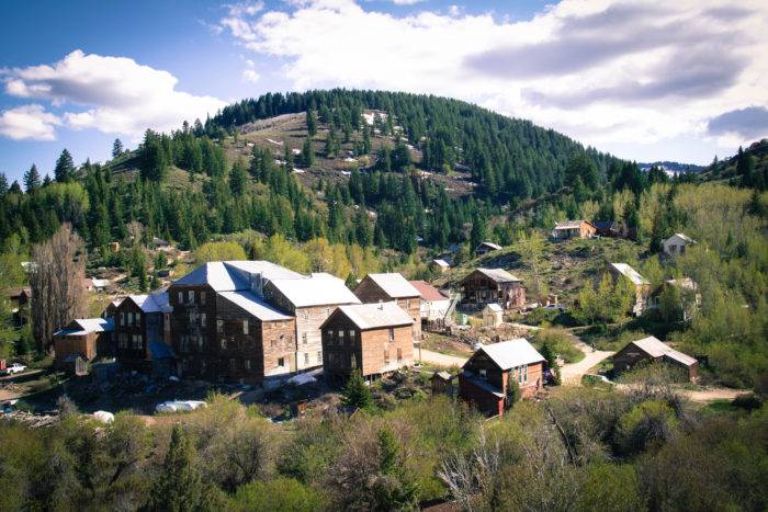
So much to explore in Silver City. Photo Credit: Steve Graepel
Silver City’s off-the-grid location (and happenstance luck avoiding natural disaster) has largely protected the town from the typical old west decay. Alone, in the mountains, it stands as one of the best-preserved ghost towns in the nation today. Seventy or so structures still remain standing ‘downtown’, just as they did back in the 1860’s. Well…almost so. No longer straight and square, most buildings sit slouched on the hills above Jordan Creek.
After a deep winter hibernation, Memorial Day marks the opening of Silver City Road, resuscitating shallow life back to the old silver town. So with the last weekend in May, we loaded the truck and made our trip in the way-back machine to get a taste of what it was like ‘back in the day.’
Our truck belched past the warning sign and up the narrow, single-lane road, which folded over itself as it climbed to New York Summit. After an hour of slow and steady progress, we crossed the culvert bridge into town and hitched our truck beneath the slumping porch of the old Idaho Hotel.
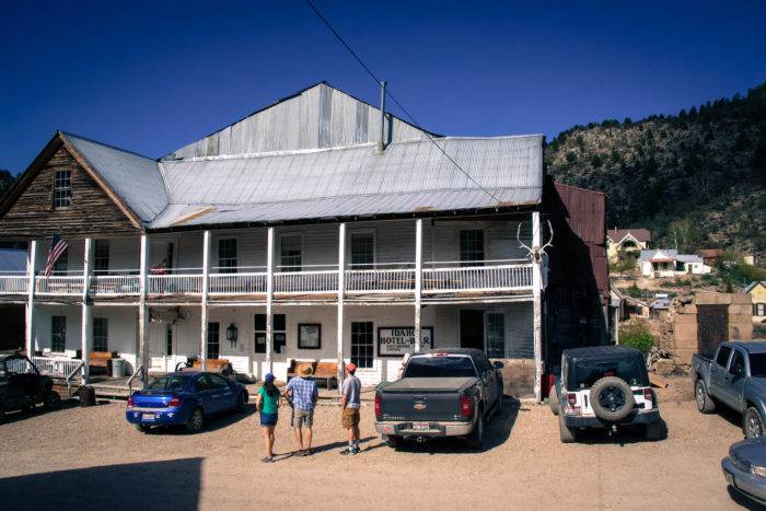
Get your adventures started at the old Idaho Hotel in Silver City. Photo Credit: Steve Graepel
The kids spilled out and immediately hoofed it over to the old County Office building-turned-knick knack shop in search of modern-day treasures in the form of polished rocks and souvenir flecks of gold.
The property is all private, and the entire township was listed as a historic district in 1972. Most structures remain as they were with minor maintenance keeping them appropriately preserved, like the old Masonic Hall bridging over Jordan Creek and the 1892 Standard School, with its fresh-whitewashed coat of paint.
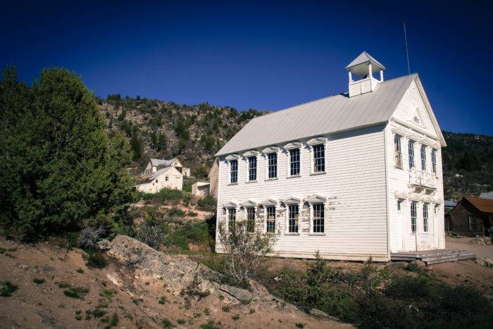
A view of the historic schoolhouse in Silver City. Photo Credit: Steve Graepel
We spent an hour or so walking the old dusty streets, circling out the backside of town with a hike up the granite slabs to the church. Perched over two mine shafts and situated well above the fray, Our Lady of Tears no doubt spent decades mindfully watching over the rough and tumble in the valley below.
We wrapped our day with a hike through Cemetery Gulch where the kids read epitaphs etched in marble and granite. Hard lives, war-torn, buried too young … every stone was a testament to the challenges of living in the old west.
Back at the truck, we saddled up and headed upstream along Jordan Creek, past the Silver City campground, where we found a quiet, riverside spot tucked away nicely under a stand of aspen and pine. The dead-end road saw occasional ATV traffic, but was mostly quiet, albeit the white noise babbling from Jordan Creek. The kids each grabbed a plate and staked a claim down by the creek, ‘panning for gold’ as my seven year old proclaimed. Flecks of quartz, schist and pyrite kept them on edge for hours.

The following morning we made a lazy departure out of town. Instead of heading back down to Murphy, we cranked the wheel left off the mountain due west, towards Jordan Valley, where we passed the ruins of the old De Lamar Mine along the banks of Jordan Creek.
Our Owyhee adventure was coming to an end. But for those with some gumption and for whom civilization can wait, the adventure could easily continue by driving out eastward along the remote and spectacular Owyhee Uplands Backcountry Byway. With abundant options for exploration, creative sensitivities and a curious eye on a map will hint at the treasures that lay in the canyonlands. And much like the silver, gold and beaver pelts before, there are plenty of them remaining to be found.
Do it Now
From Boise, find your way to Murphy, where you can top off the tank and grab any last-minute supplies. Silver City Road is about 5 miles south of Murphy.
Silver City has dry camping (no potable water or plumbing), outhouses, and little in the way of food. Bring toilet paper, food and due to potentially high levels of mercury leached from years of mining, bring your own water.
The road is suitable for most cars, though an SUV or truck with clearance will handle the upper stretches of the route more comfortably.
The Owyhees are a dusty place; expect a lunar-like dust to coat most of your car–inside, and out.
When to go
Roads in and out of Silver City are typically closed from November to May, opening up on or around Memorial Day weekend. For road status, reach out to Owyhee County Dispatch at 208.495.1154.
The Owyhees can be an unforgiving place in summer; late spring and fall are your best bets for milder temperatures.
Nearby adventures
To grasp the vastness of the Owyhees, grab a map. The red Gazetteer or DeLorme series is a good start and suitable for most automobile travel. For deeper exploration, you will want to get ahold of the 1:100,000-scale maps from Idaho Bureau of Land Management.
Steve Stuebner and Mark Lisk put out a fantastic book called The Owyhee Canyonlands. It outlines exploration options ranging from car side (the Owyhee Uplands Byway) to deeper backcountry (Little Jacks Creek), to the extremely remote (The Tules).
Silver City Hikes
Additional hikes and high routes can be accessed from downtown Silver City. One of the better ones includes the moderate 8-mile Presby Creek loop, which loops out of the Silver City Road junction with Jordan Creek Road at the New York Summit north of town.
For the climbers, another option is to follow Jordan Creek Road south of town and loop 8+ miles around Sawpit Peak by way of Sawpit Gulch. The route follows ATV trails and summits Sawpit Mountain’s summit, so the going can be steep, but views will be spectacular.
For the truly ambitious, take the 17-mile haute route above Silver City. The Skyline Mine Tour passes the Cumberland and Poorman mines where a handful of ruins still stand.
North Fork Wilderness
Parts of the Owyhees were formally introduced into Wilderness status in 2009. The Wilderness primarily protects the river canyons and the North Fork is an exemplary example. It’s a spectacular rift in the otherwise open space. The rub? There are no formal trails yet. The region can be explored cross-country, or from the BLM pullout.
To get there, take the Owyhee Uplands Byway 28 miles past Jordan Valley and drop into the BLM campground at the base of the Canyon.
Lastly
It is important to respect that much of the land in Silver City and beyond the prominent roads is privately owned and requires permission to pass through. So please stick to the main routes or get permission. Permission is best secured by getting a digital app like Xmaps and looking up who owns the property.
And finally, be prepared. While the road to Silver City sees a regular stream of visitors, beyond the ‘City’, the Owyhees can be a vastly empty space. Leave your plan with someone at home, bring spare water and a capable vehicle. Those traveling through should be prepared to be self-sufficient.
All photos, including feature image, are credited to Steve Graepel.
Artist, writer, adventurer, father of two, Steve Graepel is in constant pursuit of the balanced life. Living in Idaho, he can pursue it with gusto. Steve’s work has appeared in National Geographic Adventure, Patagonia’s The Cleanest Line and Gearjunkie.com.
Steve and his wife Kelly live in Boise, Idaho with their two children, Chloe and Ethan.
Published on July 6, 2017
