When the weather finally starts to warm up and those first few sunny days thaw the winter chill, everyone is eager to hit the trail for some hiking. Unfortunately, many mountain trails remain snow covered, and the foothills are often a soggy, muddy mess. But fear not, I have the perfect early season hiking trail for you: The Rapid River trail, just outside Riggins, Idaho!
Riggins is in the region of Idaho known as the “banana belt.” Alas, we have yet to find any bananas. Its average annual temperature is 66 degrees, making it the second warmest city in Idaho (Bruneau takes first with a 68-degree annual average). This makes for mild winters, freeing the Rapid River trail from snow quite early in the season. It’s best hiked March-June and features bright green hillsides with a wide variety of wildflowers and butterflies.

Getting There
The trailhead is located right off highway 95, just south of Riggins. Drive 2.5 miles on Rapid River Road, passing the fish hatchery on your left. The parking lot is located up a short, steep hill. It’s about a 1-hour drive from McCall, and 4 hours from Boise. Make it a fun weekend getaway by staying at the Salmon Rapids Lodge or the Big Iron Motel.
The Trail
For Beginners
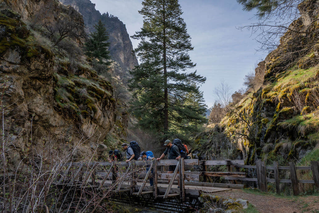
The scenery starts right away on this hike. The dramatic rock walls and rushing Rapid River make an immediate wow factor as you descend into the canyon along a dirt trail. There are several rock formations, caves and overhangs with game paths to them from the trail to the right. Holes from water erosion in the rock walls are reminiscent of southern Utah canyons. The trail comes to a bridge at exactly 1 mile. This is a great turnaround point if you have small kids, and also a great place for a quick snack. Bright green moss covers the rocks along the banks of the river in this section, giving off fantastic Pacific Northwest vibes. Though the trail is often deserted, this marks the point that receives the most hiking traffic.

Intermediate Hikers
Follow the dirt trail along the river, climbing and descending several times. One particularly steep climb occurs 2.5 miles from the trailhead. Thankfully, your efforts are rewarded with epic views looking down into the rugged canyon. At 3 miles in there are 2 lovely campsites alongside the river, and at 3.5 miles there is one more. The trail passes below a towering rock wall for one of the most scenic parts of the canyon, then rounds the corner to a second bridge at 4 miles in. If you keep an eye out, you will see numerous birds of prey swooping through the sky above.
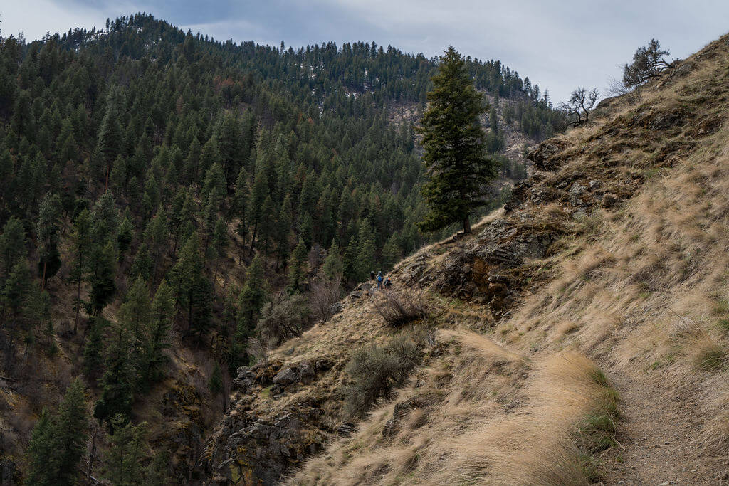
At 4.25 miles the trail will fork. Go right (up) to follow the west fork of the Rapid River. This section of the trail climbs steadily away from the water and is exposed on a steep hillside. The views open and more of the winding canyon can be seen. In peak spring, the hills are covered in wildflowers. This section is short lived but will have you breathing hard and stopping for a few breaks.
Finally, after most of the uphill is behind you, there is a historic grave site for J. Jones; who was killed in a mining accident in 1899. Then, at 5 miles there is a welcoming spot along the west fork of the Rapid River called Potter’s flat. As the name suggests, this is a flat stretch of land with green grass, plenty of trees, and a few campsites with easy access to the river. My toddler spent hours throwing colored river rocks into the gently flowing water. This is a great spot to eat lunch and another popular landmark to turn back toward home.

Advanced Hikers
Those looking for an even longer adventure can continue up the trail to the historic McCrae cabin. This section of the trail is flat for a glorious half mile, then climbs steadily up the canyon with a few short rocky sections. It passes under rock walls and remains wooded for the majority of the journey. Further down the path, 2 miles from Potter’s flat (7 miles from the trailhead), there is yet another bridge to cross over the aptly named bridge creek. From here, the path traverses a large open field for half a mile with impressive views of the mountains above and the raging rapid river below. If you time it right, this field is vibrant green with wildflowers blooming everywhere.
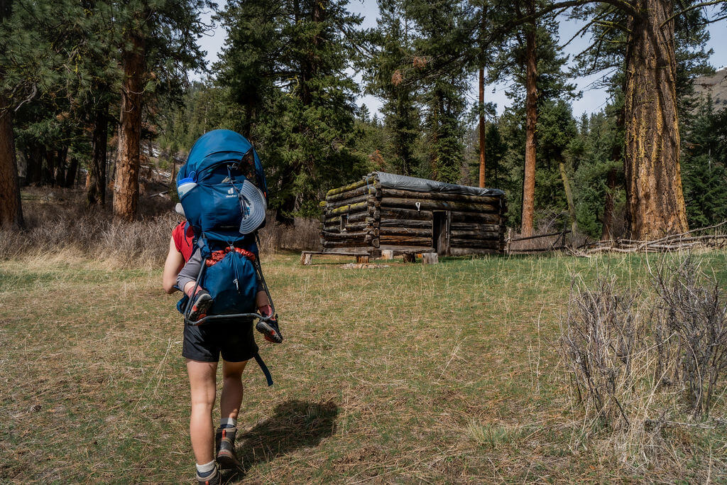
Approaching the cabin is not a harrowing task but the trail crosses McCrae creek over some unstable logs/boards. Be sure to watch your footing and keep your feet dry. The 7.6-mile mark finds historic McCrae cabin. This old homestead has some rusty tools and hunters’ bedding inside but isn’t safe to explore. There is a large rock in the clearing outside that makes the perfect spot to soak in the sun on a much-needed break.
From this point you have 2 options, you can follow the river past the cabin on a minimally traveled path or partake in another steep half mile climb behind the cabin up toward the looming Seven Devils. This way will cross McCrae creek again and leads to the remnants of Wurl cabin. Just 4 roofless walls remain perched atop a scenic ridge. Once upon a time this was most certainly an absolute paradise for the Wurl family. Just south along the ridge is an incredible viewpoint; complete with jagged rocks jutting out over the pastoral scene below. The trail, McCrae cabin, and some of the Seven Devils Mountain range can all be seen from here and it is well worth the effort and climb. When you’ve had your fill of sweeping views, it’s time for the 8-mile return trip, rounding out an ambitious 16-mile hike.

After the long winter, the Rapid River trail is a perfect retreat for those itching to get outside. Historic, beautiful, challenging—a perfect interlude to the hiking season to come. Add it to your list, Rapid River isn’t one to be missed.
Important Information
The best season to hike this trail is March – June. In the summer months this canyon heats up and gets incredibly hot. Be sure to pack plenty of water or a way to filter the river water. The warmer months bring several species of snakes to this area including the rubber boa and rattlesnakes. Travel with caution. This trail is also home to bears. Be sure to carry bear spray, hang all your food if camping, and make noise along the way. Travel with care, know before you go, and be sure to pack out everything you packed in.
Feature image is credited to Stephanie McNulty.
Stephanie McNulty is a travel writer, photographer, and content creator based in Boise, Idaho. She fell in love with mountains as a young mom and has been chasing them ever since. Stephanie can usually be found in the wild places of Idaho, the Pacific Northwest, and beyond… all with four feral children in tow. Follow her adventures on IG @thebackpackingmom.
Published on July 2, 2024
