Southeast Idaho boasts an abundance of natural beauty, from majestic mountains to serene lakes and rivers to sagebrush steppes. For outdoor enthusiasts and nature lovers, exploring the region’s hiking trails is a must-do activity.
In this blog post, we will highlight some of the great hiking trails in southeast Idaho, offering diverse landscapes and unforgettable experiences from family-friendly strolls to steeper trails with epic views.
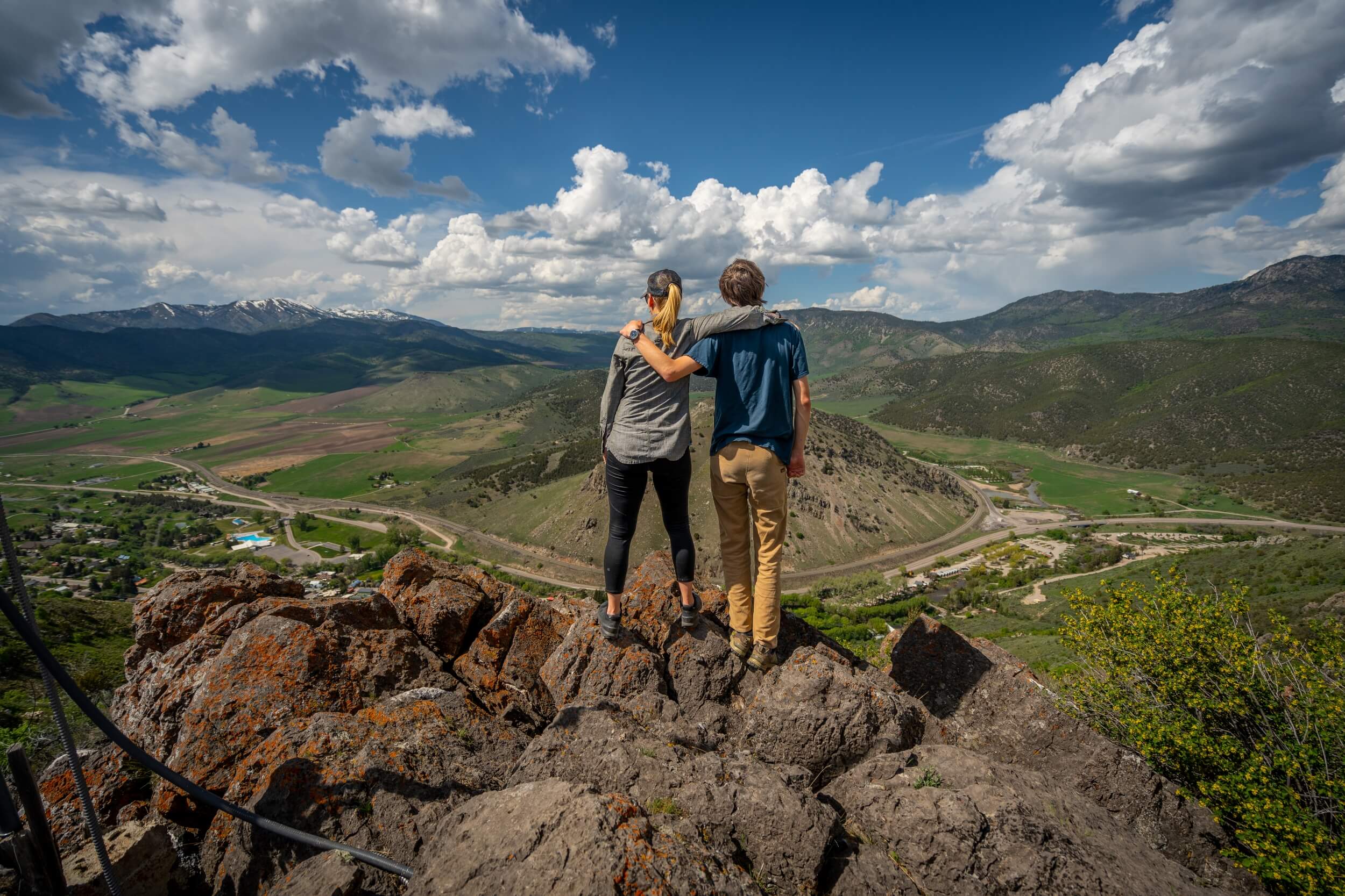
Lava Hot Springs Trails
Lava Hot Springs is a popular resort town located in southeastern Idaho. It’s well-known for its natural hot springs where visitors can enjoy the warm, mineral-rich waters. Besides soaking in the hot springs, Lava Hot Springs also provides opportunities for outdoor recreation such as hiking, biking, and exploring nearby scenic areas. The town’s charming atmosphere and the natural beauty of the surrounding region make it a popular destination for relaxation and adventure.
Mount Moh
Trail Length: Approximately 2 miles round trip, 1,167 feet gain
Mount Moh is a popular hiking destination known for its panoramic views of the surrounding valleys and mountains. The trail takes you through small aspen groves, flower-filled hillsides, and rocky terrain, offering a challenging yet rewarding adventure. Along the way, you’ll encounter vibrant wildflowers and may even spot wildlife. The summit rewards hikers with breathtaking vistas that make the steep climb worthwhile. At the summit, you may get to look down on a bald eagle soaring above the town of Lava Hot Springs and watch marmots scamper about.
In spring there are fields of arrowleaf balsamroot flowers (and lots of mosquitoes). There is little shade, so go early or late in summer.
From the trailhead begin climbing and keep going. At the Lava Canal Trail, look to the left for the trail. At the waterline path crossing look to the right for the trail. Then, just keep going up, staying on the trail, to the radio towers at the top of the hill. Mount Moh has a long north-south trending summit ridge with the electronics facility to the north. Its highest point is found on the south end of the ridge.
Directions to Trailhead: The Mount Moh trailhead is located next to The Rooftop Bar at the corner of North 3rd Ave and East 1st Aly South in Lava Hot Springs. Look for the Idaho Centennial Trail sign.
Lava Canal Trail
Trail Length: Approximately 1 mile one-way, 100 feet gain.
For something a little easier than the Mount Moh Trail, try a walk along the Lava Canal. This trail follows a path above the Portneuf River and then Fish Creek along an irrigation ditch. The trail is fairly flat and traverses the hillside below Mount Moh. Look for wildflowers in spring, people walking their dogs, and an overall relaxed vibe. The trail starts out steeply, but within a few minutes approaches the wide, flat canal path. Turn left and walk as far as you’d like.
Directions to Trailhead: Start at the same trailhead as Mount Moh Trail.
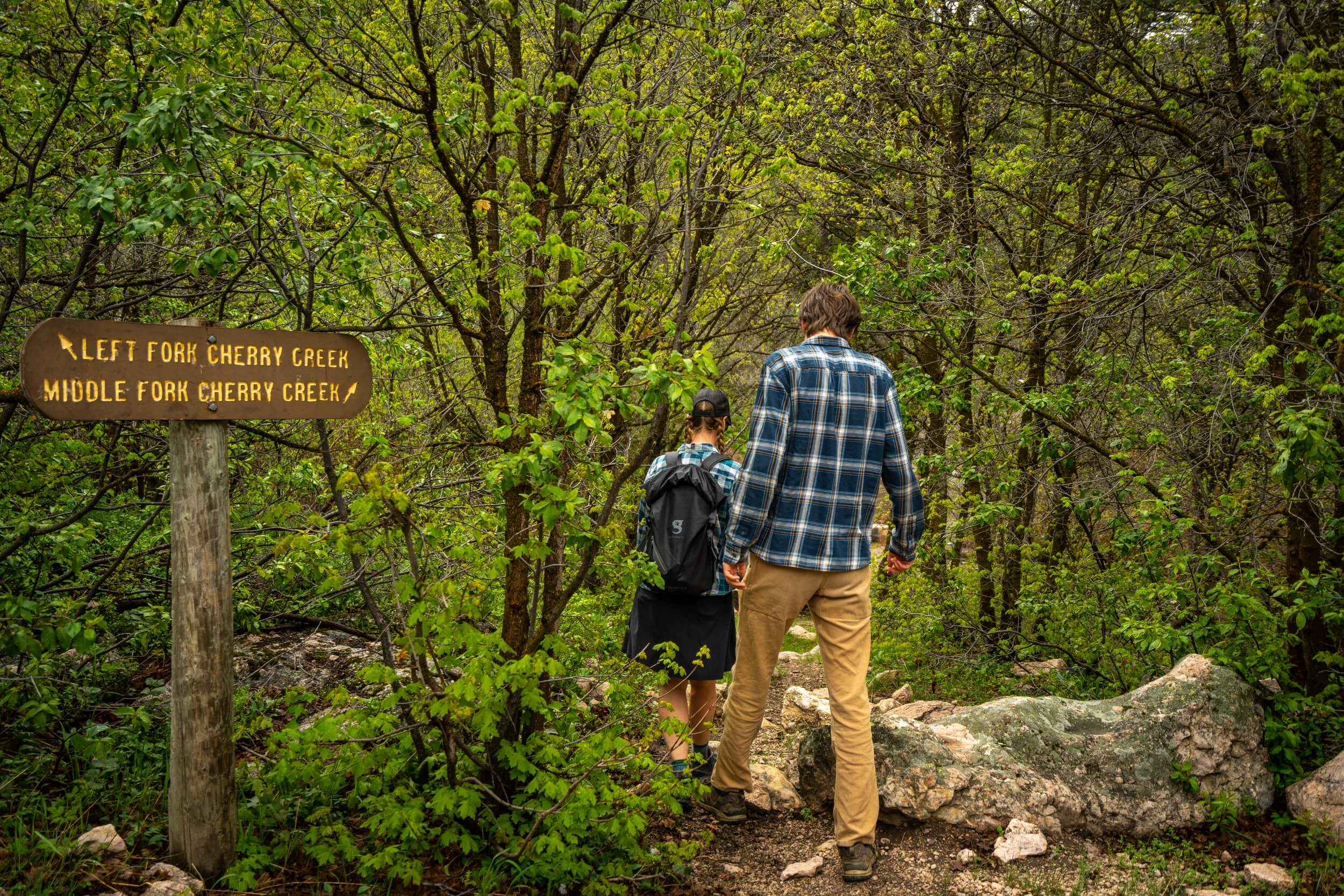
Bannock Range Trails
The Bannock Range is in southeastern Idaho and extends into northeastern Utah. It separates the Great Basin from the Columbia Basin and is named for the Bannock tribe whose ancestral land it is on.
The Bannock Range is home to a variety of wildlife, including deer, elk, bear, and mountain lions. The range is also a popular destination for ORVing, hiking, camping, fishing, and hunting.
The highest point in the Bannock Range is Oxford Peak, which is 9,291 feet (2,832 m) tall.
Left Fork Cherry Creek
Trail Length: Varies from 1 – 11 miles roundtrip, up 4,000 feet gain.
Left Fork Cherry Creek trail is an ORV trail but offers good hiking as well. The trail takes you through a lush forest, passes open hillsides of sage and arrowleaf balsamroot, and follows crystal-clear streams. Moose, deer, black bears, and other wildlife inhabit the area.
After about ten minutes of walking, the trail splits at a signed junction, stay left to follow the Left Fork Cherry Creek. The trail to the right is Middle Fork Cherry Creek and the start of the Cherry Creek Loop (see below).
As you ascend the Left Fork, the surrounding views become increasingly breathtaking. In spring there are several creek crossings that require a pretty big leap if you want to keep your feet dry. In summer, they should be easy to cross.
At around four miles, you reach a small pass. This is a good turn around point. If you were to continue on this trail, you would get to Oxford Peak, the highest summit in the Bannock Range (11 miles round trip and 4,000 feet elevation gain).
Directions to Trailhead: From Downey, Idaho, take Old Highway 191 southwest 2.2 miles. Turn left on Cherry Creek Road and continue 8 miles to the trailhead just before the Cherry Creek Campground.
Cherry Creek Loop
Trail Length: 3.9 mile loop trail.
Start hiking along the Left Fork Cherry Creek and cross the creek at the signed junction for Middle Fork Cherry Creek. The trail winds through conifers and mixed deciduous trees with a steep section in the middle and comes out at New Fork Trail 420 across the creek from the trailhead parking.
The trail can be a little hard to find at times so be sure to have a paper map or already downloaded digital map (cell service is spotty at best). Plan to cross the creek a few times, possibly getting wet feet early in the season.
Directions to Trailhead: From Downey, Idaho, take Old Highway 191 southwest 2.2 miles. Turn left on Cherry Creek Road and continue 8 miles to the trailhead just before the Cherry Creek Campground.
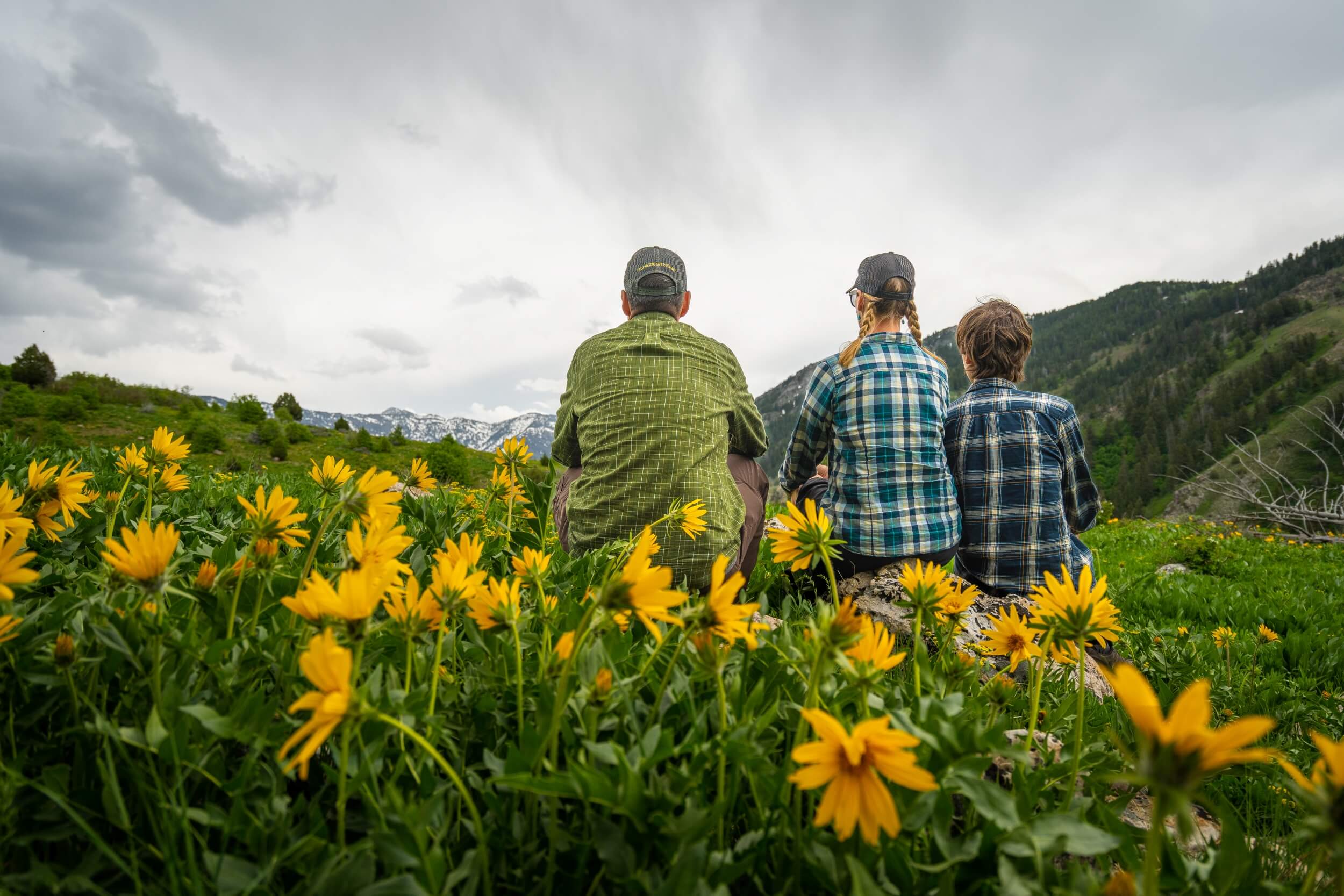
Bear River Range Trails
The Bear River Range is located in southeastern Idaho and northeastern Utah. The range is about 160 miles long and 50 miles wide. The highest point in the range is Naomi Peak, which is 9,979 feet tall. The range is home to a variety of ecosystems, including forests, meadows, and alpine tundra. The range is drained by the Bear River, which flows into Great Salt Lake.
The Bear River Range is a popular destination for outdoor recreation, including hiking, camping, fishing, and hunting.
Thorne Spring
Trail Length: Varies
Start on the Cub River Trail and head uphill (left) at first trail split. It’s an ORV trail, but nice for hiking, too. The trail get steep up to a huge meadow with views into the Bear River Range.
Continue following the trail uphill along a ridge. At about 1.5 miles you reach junction and can continue on one of several ORV trails or make this your turn around point.
In spring and early summer, the trail is filled with forget-me-not, glacier lily, arrowleaf balsamroot, and silky Phacelia blooms.
Directions to Trailhead: From Preston, Idaho, drive south on US-91 S about 4.5 miles and turn left onto E 2800 S/E Cub River Rd. Continue 9.5 miles to Albert Moser Campground. The road is paved until the National Forest Service boundary where it turns to well maintained gravel. There is a big pull through on the left for snowmobile parking in winter and ATV parking and camping in summer. Park there, near the sign for Cub River Trail.
Bloomington Lake Trail
Trail Length: Approximately 1 mile round trip
Bloomington Lake Trail is a short but delightful hike leading to the stunning Bloomington Lake.
This alpine lake is nestled amidst towering peaks and offers pristine, turquoise waters that captivate the senses. The trail meanders through a forested area, providing shade and a pleasant atmosphere during the hike. Once you reach the lake, take a moment to soak in its beauty and tranquility.
Directions to Trailhead: To access the Bloomington Lake Trail, drive southeast from the town of Paris on US Highway 89. Turn right onto Bloomington Canyon Road and continue for about 8 miles until you reach the trailhead parking area.
Historical Trails
These two “trails” north of Preston, Idaho aren’t really hikes, but are fascinating points of interest worth stopping for and stretching your legs.
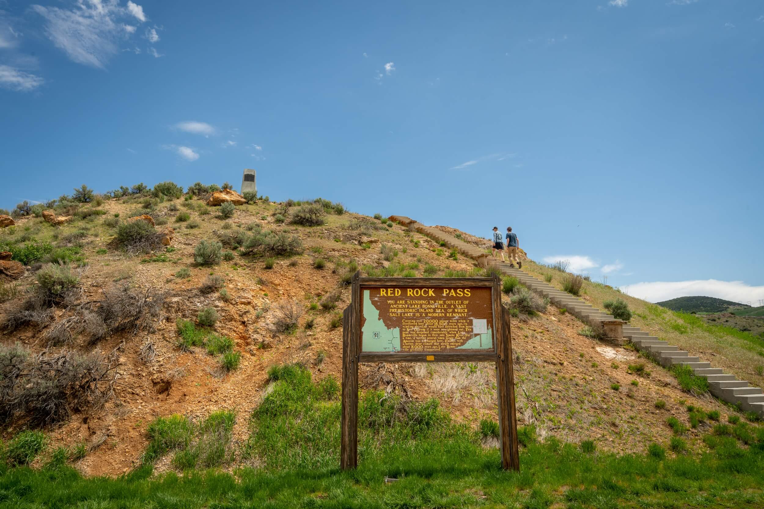
Red Rock Pass
Trail Length: 73 steps
Red Rock Pass is a geologic site at the outlet of Ancient Lake Bonneville. North of here, water flows into the Snake, Salmon, and Columbia Rivers, while water flowing to the south ends up in Great Basin and the Great Salt Lake.
There are a couple of interpretive signs in the parking area. Then climb the 73 concrete steps to the top of the hill where there is a memorial to Mormon soldier Joseph Hunt and a great view of the surrounding area.
Directions to Trailhead: The signed pullout is on the east side of US-91 about 22 miles north of Preston, Idaho or 7 miles south of Downey, Idaho.
Bear River Massacre Memorial Park/Overlook
Trail Length: 100 yards
Follow a short, paved path around the overlook reading interpretive signs about the Bear River Massacre – the worst massacre of Native Americans in the West. The signs explain what life was like for the Shoshone people before the massacre, what led to the massacre, and where events took place.
Directions to Trailhead: From Preston, Idaho, drive about 6 miles north on US-91 to an overlook on the east side of the road.
Southeast Idaho is a treasure trove of remarkable hiking trails, each offering its unique blend of natural beauty and adventure. Whether you’re seeking panoramic mountain views, tranquil lakes, or peaceful forested paths, or a lesson in history, these trails mentioned above provide a fantastic outdoor experience.
Melynda Harrison writes about travel and outdoor family adventure at TravelingMel.com, YellowstoneTrips.com, and many local and regional publications. When she’s not behind a laptop, you can find her cross-country skiing, hiking, floating a river, or traveling to far-flung locations.
Published on August 27, 2024
