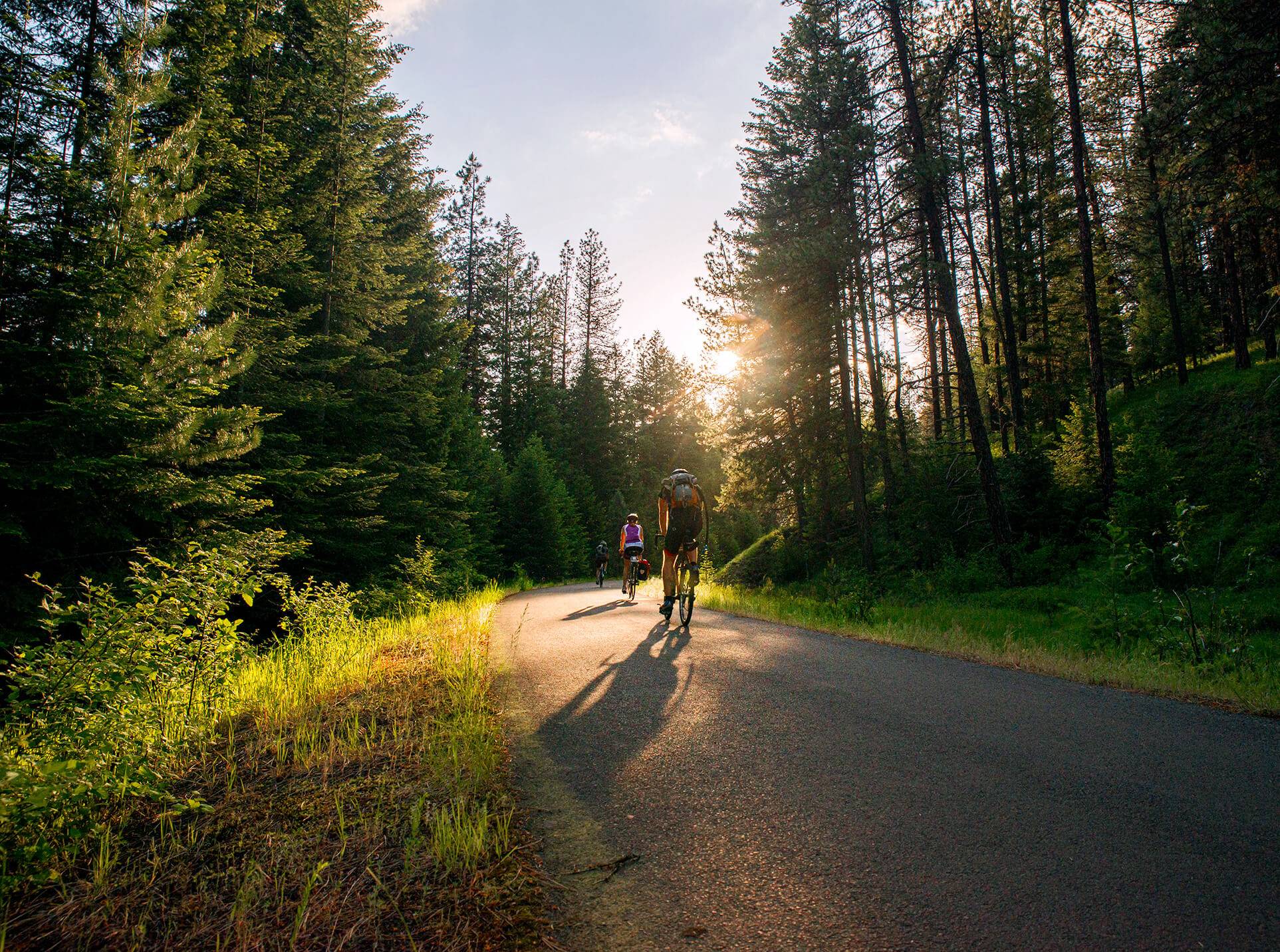
A quick note: we chose to ride the Trail of the Coeur d’Alenes both directions, beginning in the west, staying overnight near the Montana border and returning the next day for a total distance of 144 miles. Many riders prefer to ride just one direction and there are shuttle services that will accommodate this, returning you and your bike by van to your starting point. Additionally, the plentiful stops and road crossings allow for a very customizable itinerary and plenty of restrooms and picnic areas line the trail. Ride as much or as little as you’d like; break it up into more manageable pieces; make it work for you—you can’t go wrong!
My wife and I first heard tell of the Trail of the Coeur d’Alenes two years ago, over beers at a trailside brewery in Seattle, from two grinning, grizzled, sinewy cyclists. They spoke of it in reverent tones, lauding the buttery-smooth pavement, the endless solitude and eye-popping vistas, the pleasant grade and the proliferous wildlife. We were hooked and vowed to seek out this cyclists’ Shangri-La. This spring, along with two good friends, we made our move.

The Trail of the Coeur d’Alenes is a railroad-grade cycle path that stretches from border to border across the Panhandle, roughly 72 miles end-to-end, and is a brilliant microcosm of the rich biological, climatological and topographical diversity that Idaho offers. Throughout the ride, cyclists pass from prairie into dense forest, across immense wetlands and lakes, along winding rivers and into the Rocky Mountains. Wildlife viewing is nearly constant along much of the route and, being a former railway, inclines never exceed three percent.
A large statue of a tribal warrior riding horseback marks the beginning of the trail in a nondescript park just north of downtown Plummer. The park itself is a memorial to tribal warriors who fought both in defense of tribal autonomy prior to white settlement and then subsequently in the U.S. Armed Forces.
The prairie and farmland on which the trail begins comes to an end abruptly just a mile into the ride where the forest closes in rapidly on the trail. For the next five miles, the path winds downhill at a 3% grade through verdant glades of ponderosa and fir, dotted with spring wildflowers including Lupines, Foxtails, Balsamroot, Buttercup and Milkvetch, to name just a few. The rapid arboreal descent brought us past Heyburn State Park around nine miles in (Chatcolet Campground was a great place to spend the nights before and after our ride) and into lake country.
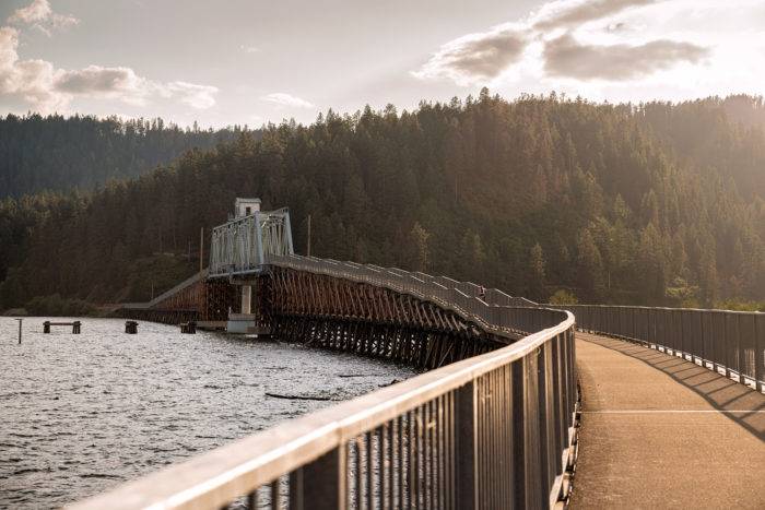
Suddenly, just as the trail leveled out, Chatcolet Lake sprawled ahead of us to the east, split in two by the trail as it runs over the Chatcolet Bridge, formerly a Union Pacific Railroad passage. It’s the first of a handful of scenic bridges spanning waterways along the length of the trail and osprey and swallows nest in the iron trusses overhead. Across the bridge, the trail continues along the lake shore for another seven miles to the charming town of Harrison. This is the first major stop along the trail and also happens to be the last for quite some time. The marina and downtown areas offer a few restaurants and stores to resupply, as well as potable water and a few grassy picnic tables to rest and snack. Here, signs about soil toxicity warn cyclists and joggers that high levels of heavy metals, particularly lead, can be found in off-pavement areas—a legacy of the mining industry. In short, don’t eat the dirt!
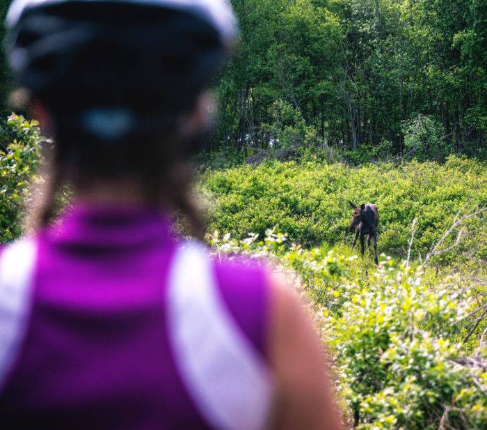
We left Harrison and entered the sprawling wetlands and lakes that break up much of the territory south of Coeur d’Alene. The next 35 miles of trail run across dozens of lakes and marshes and is the wildlife epicenter of the ride. We biked past a half-dozen moose, lazily munching on aquatic weeds and just as many deer and rabbits bounding across the trail. Water birds are the real spectacle as dozens of osprey, Great Blue Herons, swallows and swifts, Red-Winged and Yellow-Headed Blackbirds, Bald Eagles, Mountain Bluebirds and even American White Pelicans dip and dive around and above you as you ride. The occasional painted or box turtle can be seen sauntering across the pavement and garter and ground snakes are known to slither out onto the trail to sun. We may as well have been biking through a zoo.
Eventually, the wide-open marshland and lakes become fewer and farther between, replaced by thicker forest and the steadily winding Coeur d’Alene River. The trail crosses I-90 in Cataldo, the first significant outpost since Harrison, where a tiny RV park and campground provide a great stopping point for cyclists aiming to split the ride up a little more. Traveling east from there, we were concerned that our proximity to I-90 would make the trail noisy, smelly and ugly, as most interstates tend to be, but we were pleasantly surprised to find that we couldn’t even hear the roadway, never mind see it, for much of the next stretch. In fact, with the river crisscrossing the trail several times, the section between Cataldo and Kellogg was one of the most beautiful of the ride.
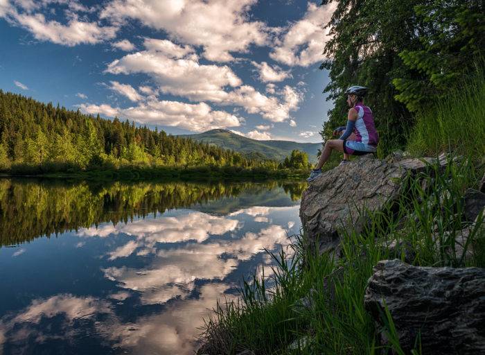
When we arrived in the towns of Smelterville, Pinehurst and Kellogg, we knew were on the home stretch for our first day. We were now in the Silver Valley—mining country—and a series of signs lined the trail detailing the history of the region, pointing out pertinent landmarks. While silver mining was king in northern Idaho at the turn of the 20th century, zinc and other metals were commonly extracted from the rolling hillsides as well. Today, huge mounds of mine tailings line the trail and highway between towns, leftover from the industry’s heyday. This area was also remarkable in that we found a trailside coffee shop, the Espresso Barn and a few stores where we could resupply.

The trail continues another fifteen miles or so on a slight but steady ascent through a few more small towns before reaching our end point, the town of Wallace—a holdover from the mining era that has fully embraced its “touristy” reputation. Nestled in mounding green hills along the interstate, Wallace was the regional hub for miners in the late 1800s and even reached a population of nearly 4,000 in the run-up to World War II. The history of Wallace is colorful, to say the least, replete with shootouts, espionage, fires, bombings and guerilla warfare between miners and mine owners—everything you’d come to expect from a true wild-west town. To cap things off, in 2004 the Mayor declared a downtown manhole cover “The Center of the Universe.”
We spent the night at the Wallace Inn, in part due to its proximity to the trail and in part due to its hot tub and sauna, which were perfect for helping to restore our road-weary legs. We loaded up on tasty burgers and beers at Albi’s Steakhouse before calling it a night but returned downtown for a hearty breakfast at the Redlight Garage the next morning. It was here we came to find out that the 1997 Pierce Brosnan thriller Dante’s Peak was filmed in Wallace and the hill behind us had been digitally altered to look like a volcano.
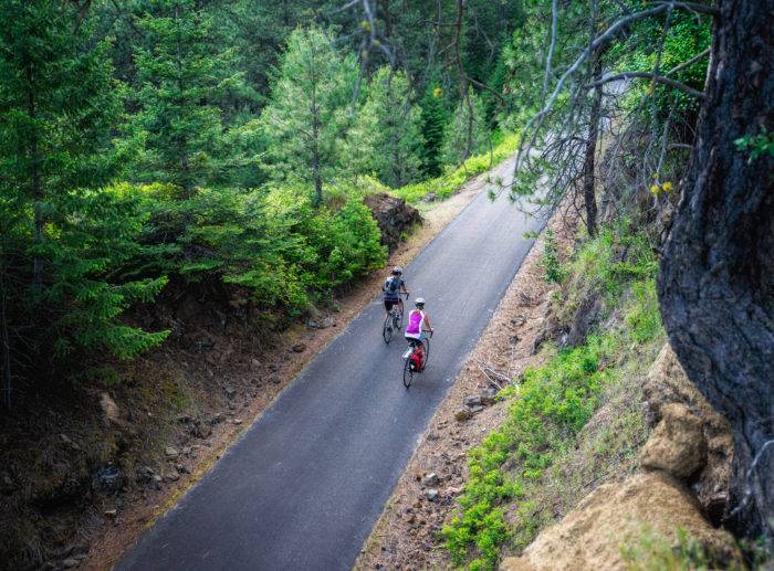
After breakfast we set back out west on our return trip to Plummer, enjoying the slight decline in the trail over the first fifteen miles. The ride was no less stunning going the other way and we didn’t regret repeating our first day’s itinerary in reverse. More moose, deer and birds, equally serene picnic spots, the same plentiful sunshine and cool spring breeze—no matter the direction, the Trail of the Coeur d’Alenes never ceases to deliver. This is Idaho at its best.
All photos, including feature image, are credited to Nick Lake.
Nick Lake is a freelance photographer, writer and videographer living in Seattle, Washington. He loves to tell stories about adventures in the outdoors and you can usually find him in the mountains hiking or skiing with his wife and puppy. Follow along on his adventures on his Website, Instagram and Facebook.
Updated on June 20, 2025
Published on July 7, 2016
