
Nick Lake worked in partnership with Visit Idaho to create this Travel Tip.
I’d been hiking on an old jeep road within the Pioneer Mountains near Hailey for over five miles when the route finally broke free from the spruce and fir into the broad, rolling meadows of Big Basin. While the scenery was magnificent, I was even more struck by the fact that I hadn’t seen another person since branching off the main path to the adjacent Hyndman Basin several miles back.

Though the trail had been easy so far, the elevation in the Pioneer Mountains was giving me a bit of a hard time. The trailhead into the area begins at a lofty 7,000 feet above sea level and climbs from there, albeit gradually, for most of the hike. After briefly dropping across the North Fork of Hyndman Creek, the path leads gently upwards for a few miles through open, grassy meadows and sunny aspen groves with a few patches of late-summer wildflowers (purple aster, paintbrush and an occasional Bluebell). The leaves of the aspen trees at times—showcasing slightly yellowed edges—were harbingers of the oncoming autumn season, and the meadow ryegrass had long shed any semblance of green in lieu of a harvest hue.
Navigating the Pioneer Mountains
Cobb Peak, an impressive massif with a gnarly south face, dominated the horizon for the majority of the hike. When I finally emerged into Big Basin proper, a world of peaks and valleys unfurled before me. Old Hyndman, my main objective on this Pioneer Mountains excursion, began to poke its serrate head up over a formidable headwall to the north while the massive bowl wrapped almost a full 360 degrees around me. The valley progressed, stepping up successively in golden humps to steep, talus-covered escarpments and a few stubborn patches of snow that, no doubt, were beginning to celebrate their survival of the hot Idaho summer.
After pitching my tent and hanging my food from one of the scant white bark pines, I continued up the next headwall to the north, finding a strenuous path up a grassy vein between the boulders and into the upper basin below Cobb and Old Hyndman peaks. Two lakes rippled lazily in the midday breeze, and a few larger snowfields stretched up into the moraine. Aiming for the lowest point on the saddle above and to the east of Old Hyndman Peak, I picked my way up the loose scree and across two snowfields, eventually gaining the ridge just above 11,000 feet. From there, the views opened up across the entire heart of the Pioneers, dropping off the sheer north face of Old Hyndman and Hyndman peaks, down to Arrowhead Lake and further north into Wildhorse Canyon, some 4,000 vertical feet below.
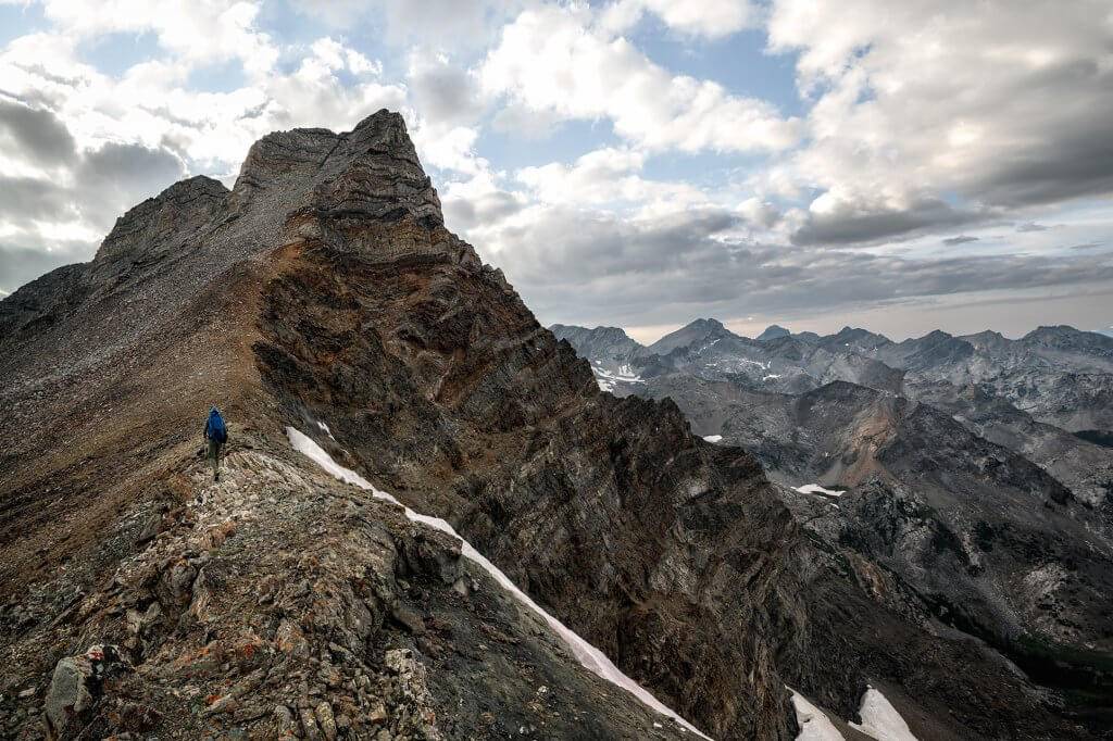
This last section of my climb through the Pioneer Mountains proved to be easier than I’d anticipated, and in what seemed like no time, I topped out through a notch onto an exposed talus slope dropping west into Hyndman Basin. Hyndman Peak rose along a stark, serpentine ridgeline to its prominence as the tallest peak in the range, and Cobb Peak’s impressive north face connected along a ridgeline to the south. Behind me was a 4,000-foot drop straight down into the valley below, and views to the east extended from the summit all the way out to Mackay and the Lost River Range’s 12,000-footers. Alone on this remote peak, I was awestruck by the horizon-to-horizon views of gorgeous mountains and valleys.
After a brief break to gawk at the mountain eye-candy around me, I began my final push to the summit above. Truthfully, I was a bit nervous at the sight of the Black Rock Dike, which led from the top of a broad apron to the summit. From most angles, the narrow ribbon of jet-black sedimentary rock looks nearly vertical and perches above a long runout of boulders down to a formidable cliff. But as I gained the saddle and circled the summit to the east, it became clear that the dike was much friendlier, and its true pitch came into focus. Donning my helmet, I began the slog up the last 600 or so vertical feet, carefully picking my way along scree, testing each step to ensure the rock underfoot would hold.
Descending the Pioneer Mountains
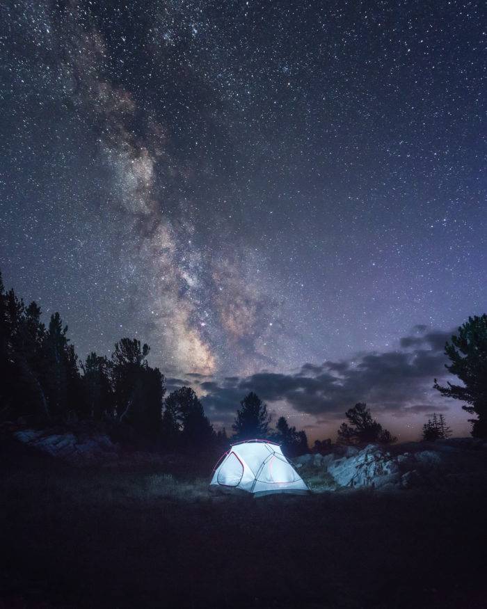
After signing the summit register, I began my descent and eventually landed back at camp in the valley below. As the sun set, the Milky Way rose, only to be replaced a short time later by a bright, waning three-quarter moon. Alone in the valley that night, I was reminded of exactly what it is that makes Idaho so special. After warming myself in the sun the next morning, I packed up camp and returned via the same trail I’d taken in, stopping to swim in the breathtaking waters of Big Basin Creek.
A Bonus Adventure in Wildhorse Canyon
Passing a pair of bow hunters (and two elk who were lucky enough to have narrowly missed them), I arrived back at the trailhead ready for another quick adventure in Wildhorse Canyon to the north. Passing through Ketchum and Sun Valley Resort, I circumnavigated the western flanks of the range, grabbing views of the Devil’s Bedstead (a brutal-looking peak if I’d ever seen one), eventually dropping south into the canyon along a dirt road. Camping along the roadside is permitted and abundant, and I found a quiet spot in a meadow beside Wildhorse Creek to spend the night.
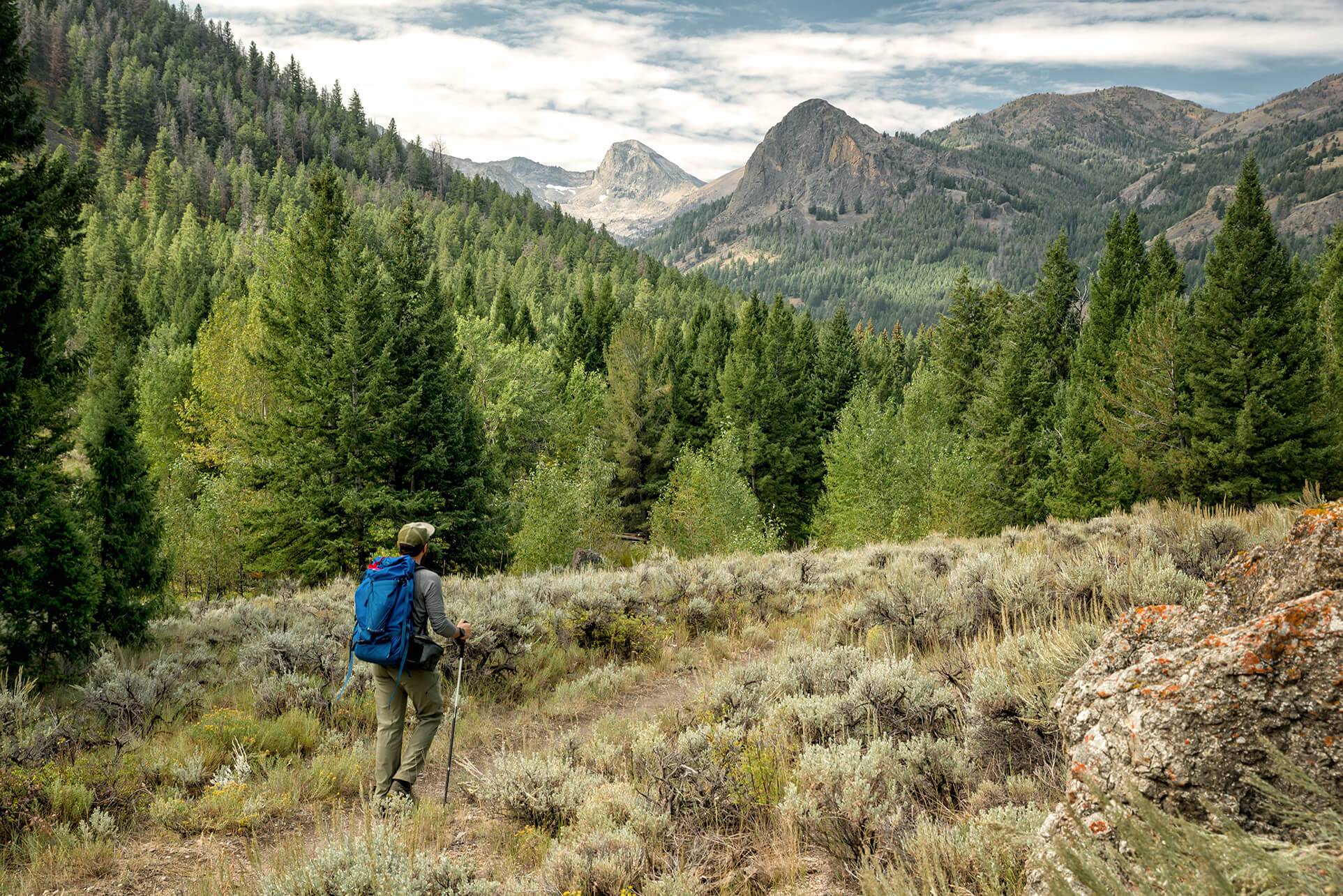
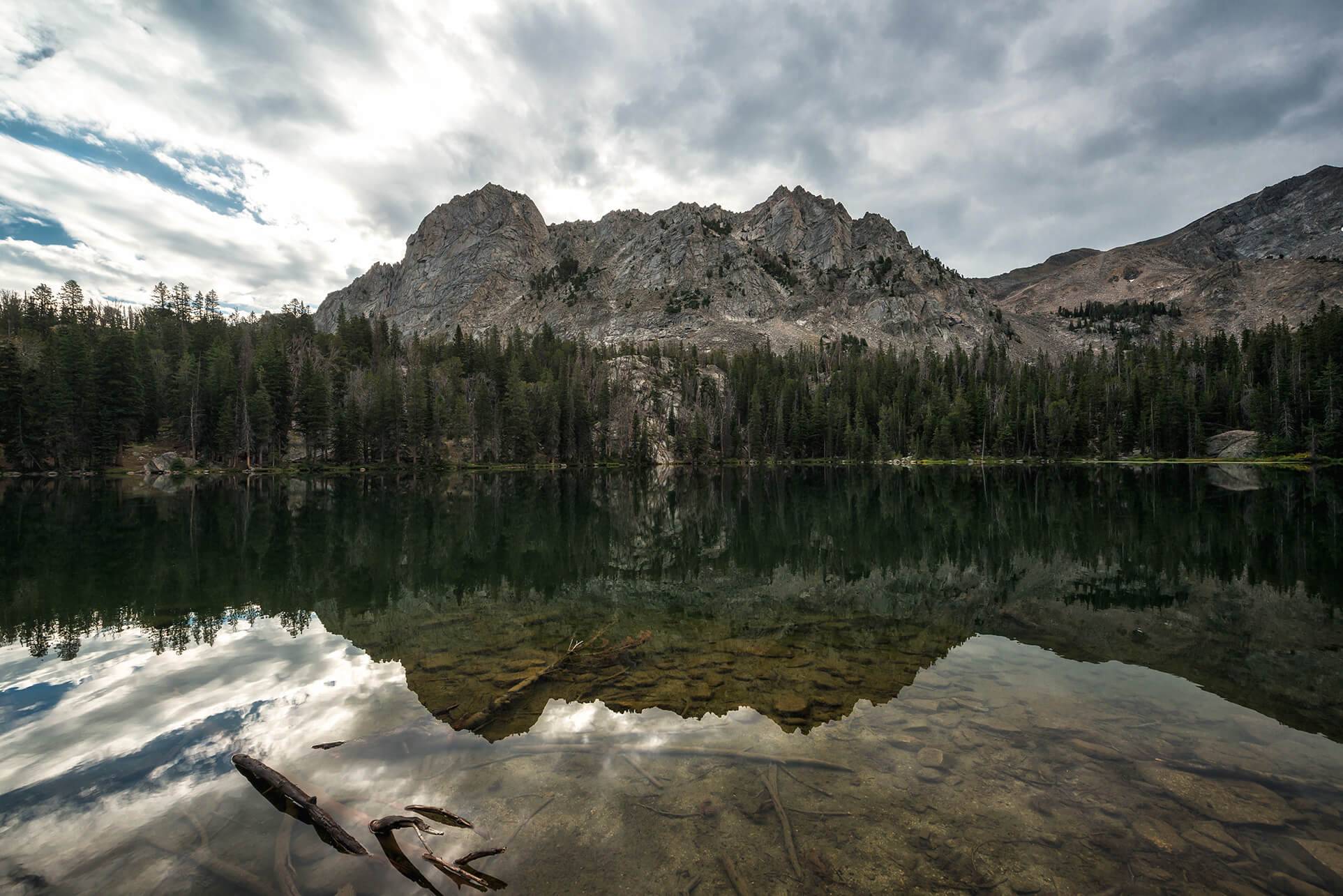
The next morning, I rose a few hours before sunrise to take a quick jaunt up to Moose Lake. The trail to Moose Lake begins along Falls Creek and bisects a wide valley filled with sagebrush before cutting steeply up and into an alpine basin. The trail is heavily wooded until abruptly breaking free into a stunning moraine ringed by toothy peaks. Moose Lake was calm and reedy and, once again, I found myself alone to enjoy the views and solitude. Heading back down the trail, I saw nary a soul until I arrived at my car. From there, I headed off for a quick, relaxing soak at Frenchman’s Bend Hot Springs west of Ketchum.
Parting Thoughts
Though I only got a small taste of the Pioneer Mountains, it was clear that they’re yet another of the Gem State’s magical, underrated treasures. Sipping a pint of Pilsner and enjoying a burger at the Sawtooth Brewery back in Ketchum, I watched puffy white clouds skip across the sky. I reflected on how incredible the last four days had been and began jotting down the peaks and basins I planned to visit on my next trip there. It won’t be soon enough.
Feature image credited to Nick Lake.
Nick Lake is a freelance photographer, writer and videographer living in Seattle, Washington. He loves to tell stories about adventures in the outdoors and you can usually find him in the mountains hiking or skiing with his wife and puppy. Follow his adventures on his Website, Instagram, and Facebook.
Updated on August 05, 2024
Published on October 31, 2017