Scott Marchant worked in partnership with Visit Idaho to create this Travel Tip.
If you are visiting the beautiful Wood River Valley, home to Sun Valley, Ketchum, and Hailey, you are likely there to experience the great outdoors. This spectacular area is surrounded by three mountain ranges, the Pioneer, Boulder, and Smoky Mountains. Although a plethora of hiking trails dot the area, finding accessible trails can be challenging.
Fortunately, there are a few outstanding accessible trails designed with sturdy surfaces, minimal inclines, and wide paths for wheelchair users and others with mobility devices. Here are three must-visit wheelchair accessible trails: one in the lofty Pioneer Mountains, the other in the multi-hued Boulder Mountains, and one that is very close to the Sun Valley Resort in Wood River Valley. All three trails are typically snow-free from June through the first week of October, offer magnificent scenery, and opportunities to see wildlife.
Murdock Creek
The Details
2.0 miles out-and-back
200 feet of elevation gain
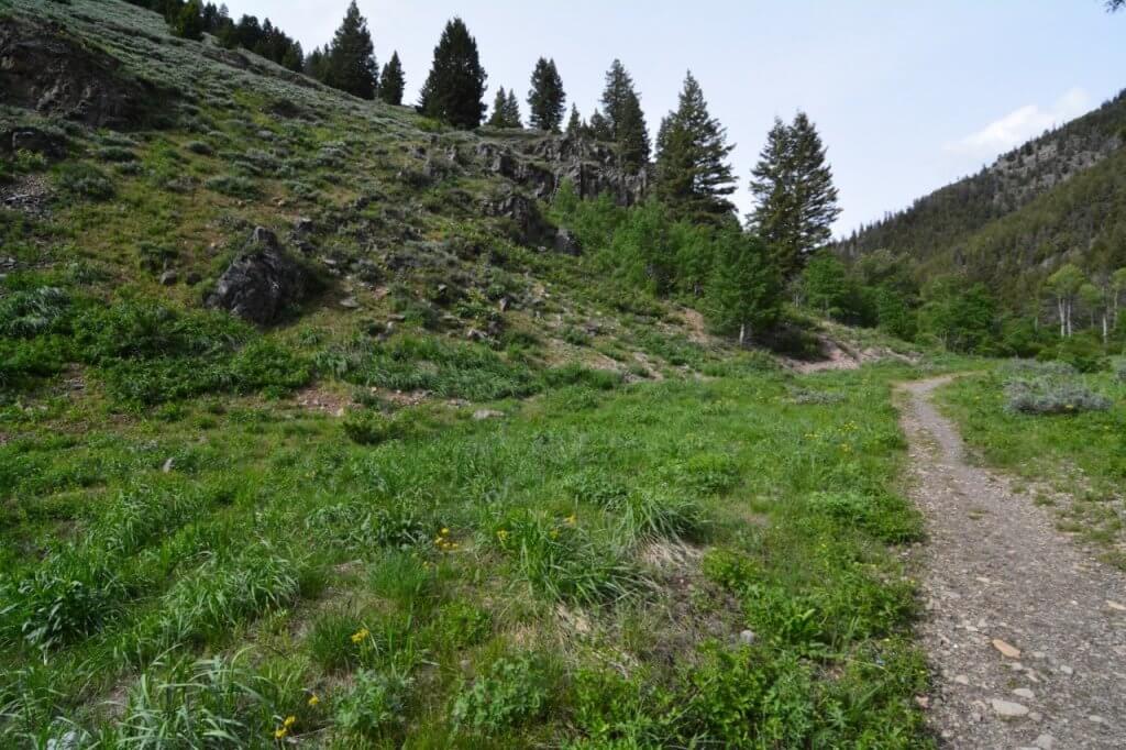
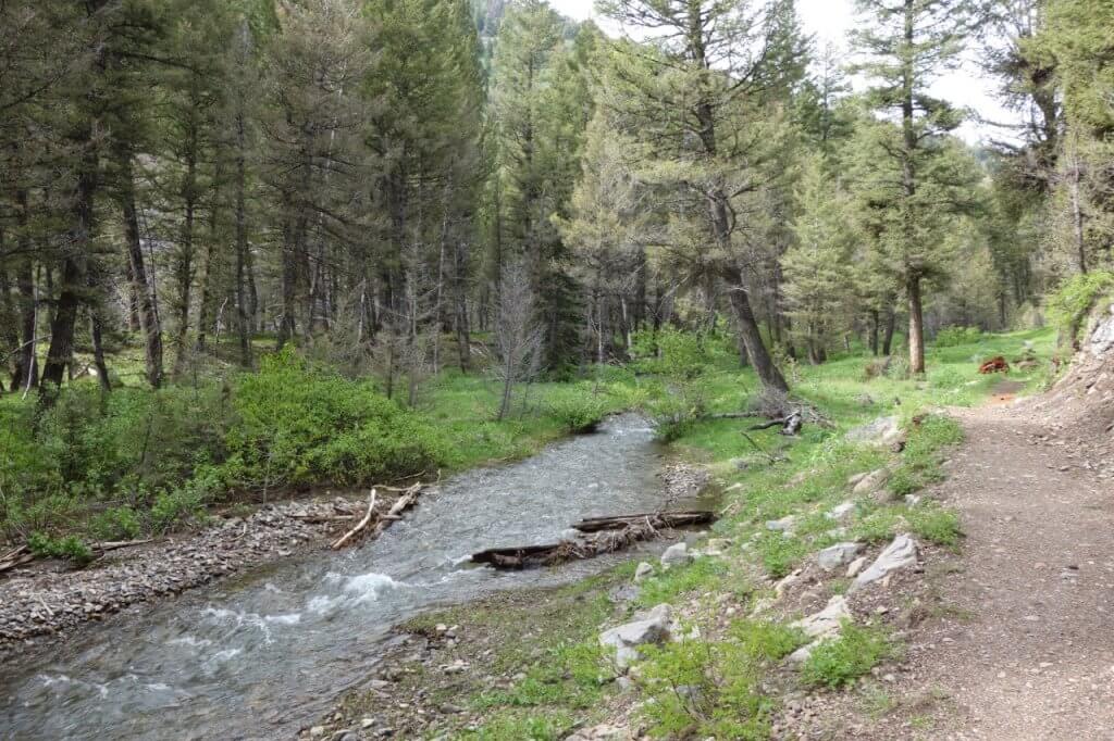
This wonderful out-and-back venture leads up a classic V-shaped canyon scattered with fragrant Douglas-fir forest. Located in the Boulder Mountains, the cascading Murdock Creek parallels the trail for most of the route and users will find many shaded opportunities for a scenic, creekside picnic.
The first section—approximately the first mile—of the Murdock Creek trail was constructed in 2010 for accessible users. The trail is 36 inches wide, non-motorized, composed of both crushed gravel and compacted dirt, and cleared of any large obstacles. Two sturdy bridges span the ambling Murdock Creek within the first mile of the outing.
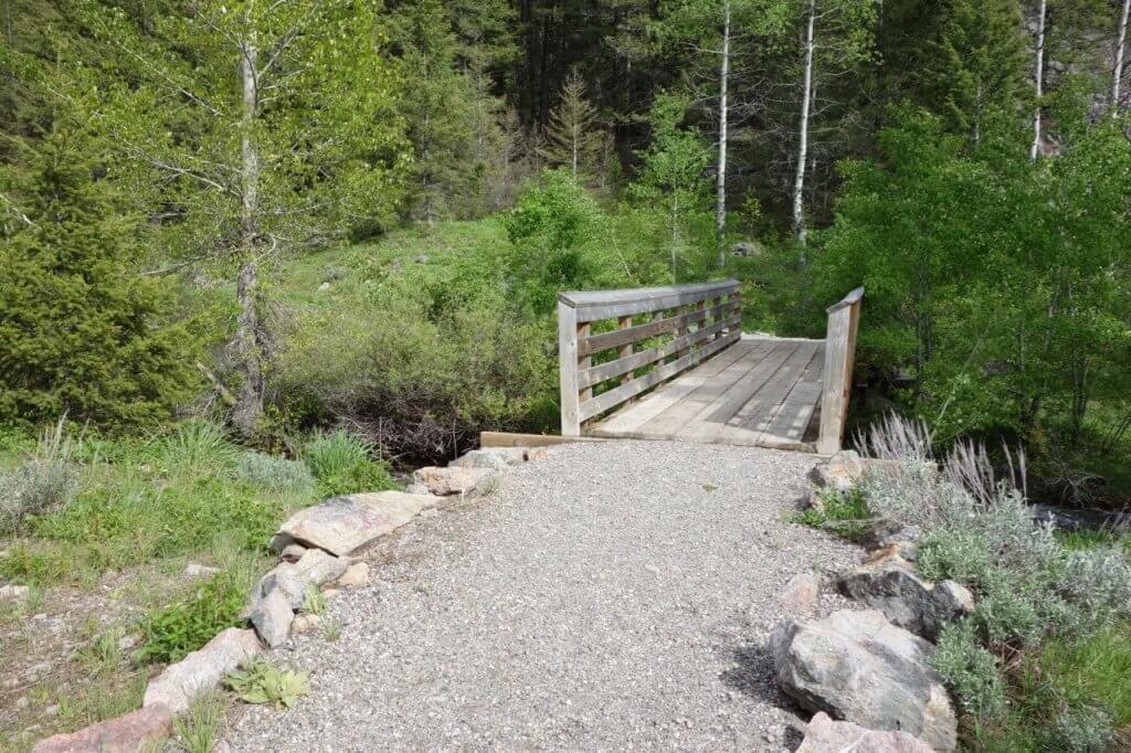
The jaunt begins at the mouth of the canyon (elevation 6,500 feet) where silver and gray-colored outcrops creep up the west facing slopes. After a quarter-mile, you pass over the first bridge spanning Murdock Creek. Beyond here, the trail veers north under a canopy of enchanting Douglas-fir forest, only feet from Murdock Creek’s grassy bank. Picnic opportunities abound. At 0.6 mile, pass over the second bridge. The route now weaves along the grassy canyon floor through open forest. At approximately one mile, the trail narrows and this is the end of the accessible outing. Although the trail continues a few more miles north, it transitions to a talus-covered, narrow, single track that climbs steeply up the west facing canyon wall.
Trailhead directions: From downtown Ketchum, drive north on ID 75 for 7.8 miles and turn right on Forest Road (FR) 146. Drive past the Sawtooth National Recreational Headquarters and Visitor’s Center—worthy of a visit—as the road transitions to a dirt surface. At 1.1 miles, turn right at a sign for Murdock Creek. Follow this road 0.4 mile to its end and the large, unshaded parking area.
Waterfall Trail
The Details
1.4 miles out-and-back
100 feet of elevation gain
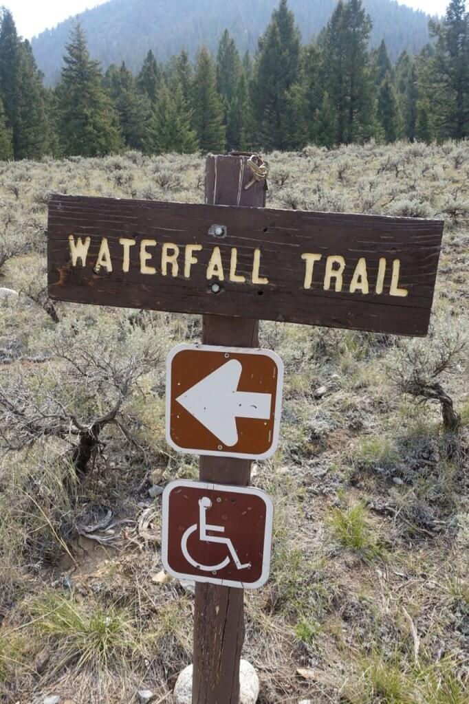
On the eastern side of the Pioneer Mountains, near the wildlife rich and beautiful Wildhorse Canyon, is the remote Waterfall Trail. Sitting at an elevation of 7,300 feet, the three-quarters of a mile long, wheelchair accessible trail is wide enough to walk two abreast and leads to a wooden deck perched just 20 feet away from a stunning, three-tiered waterfall. The deck contains a picnic table and wooden benches, shaded by beautiful Douglas-fir forest. This may be one of the most scenic accessible trails in Idaho.
The trail begins in an open area, but quickly enters Douglas-fir forest scattered with a few lichen-covered granite boulders. At 0.3 mile, you enter a sagebrush flat for a quarter-mile. A bench is located at 0.4 mile, a good location to scan the north-facing towering ridges for mountain goats. At 0.6 mile, the trail enters Douglas-fir forest again and comes to the redwood deck within 500 feet.
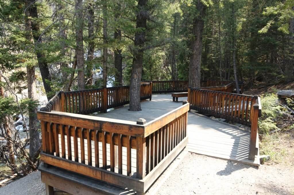
The trail was designed for wheelchair use, but is considered a moderately challenging outing. The trails surface is crushed gravel, making it more difficult to navigate than a paved trail. There are two short stretches with a 5% grade. Although the distance to the trailhead from Ketchum is nearly 30 miles, the spectacular scenery along the drive is worth every mile of the trip.
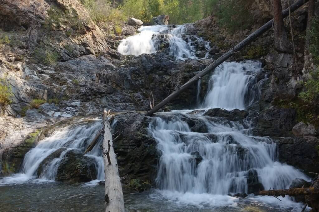
Trailhead directions: From downtown Ketchum, drive east on Sun Valley Road, which transitions to Trail Creek Road (the road changes to a dirt-surface at 9.3 miles), for 22.2 miles. Turn right on FR 135. Continue 2 miles to a Y-junction and turn right on FR 136. Continue on this road for 3.4 miles and turn left on FR 503. This road dead ends in less than a half-mile at the unshaded trailhead. There is a metal table, fire pit, and a handicap-accessible vault toilet.
Trail Creek Trail
The Details
1.2 miles out-and-back
75 feet of elevation gain
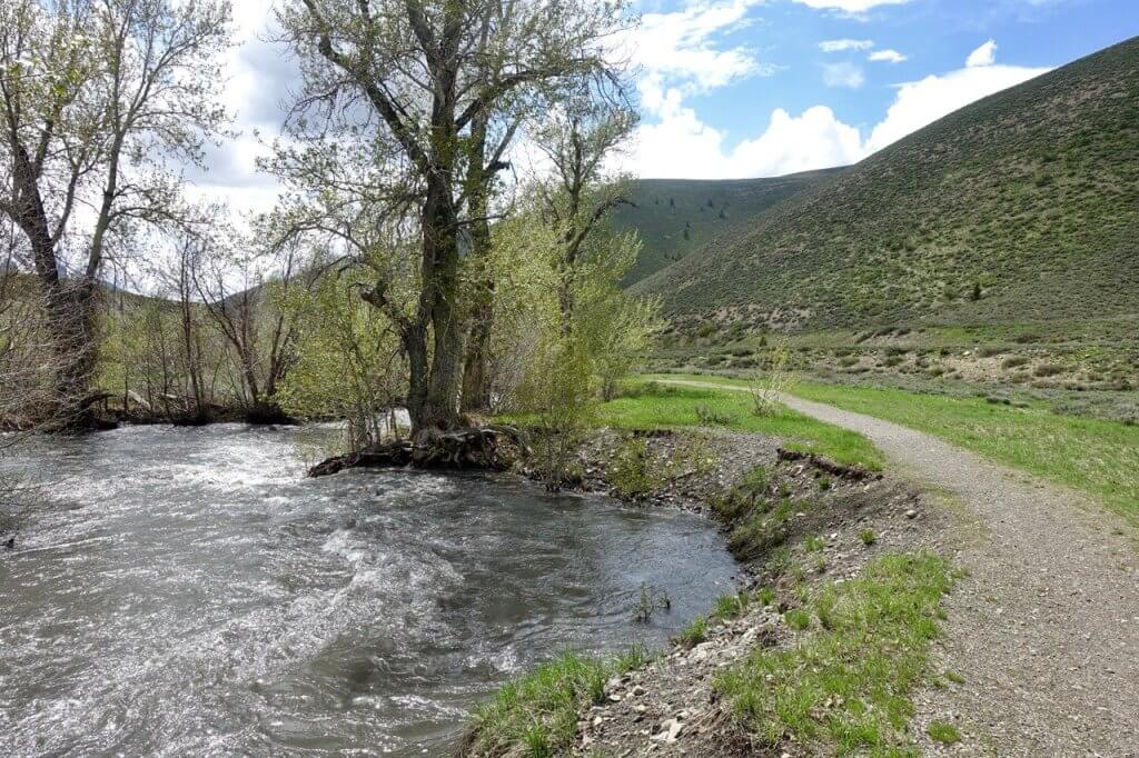
You won’t need to make much of a time investment getting to this trailhead because it is only four miles from Ketchum. Although the trail follows Trail Creek from Ketchum for several miles, the section near its end is accessible friendly and also the most scenic. The wide trail parallels the winding, cottonwood-lined Trail Creek the entire route. The outing ends near another parking area, 0.6 mile from the start of the outing. Along the way, there is a sitting bench to enjoy the scenery (at 0.2 mile), a picnic bench at a little more than a half-mile, and views of Bald Mountain looming over Ketchum. Although the trail is near the creek, most of the route is sun exposed so plan accordingly.
From the parking area, veer left (east) on the crushed gravel trail. The trail narrows a bit after 500 feet and soon passes a wooden bench. At 0.3 mile, Douglas-fir trees stretch up the steep hillside south of the creek. The trail winds past a big bend along Trail Creek where you will find a picnic bench, although it is about 50 feet from the trail. At 0.6 mile, there is an unsigned junction. This is a good place to return to the trailhead. You can veer left at the junction to another parking area and continue east on the trail another 600 feet to a final parking area.
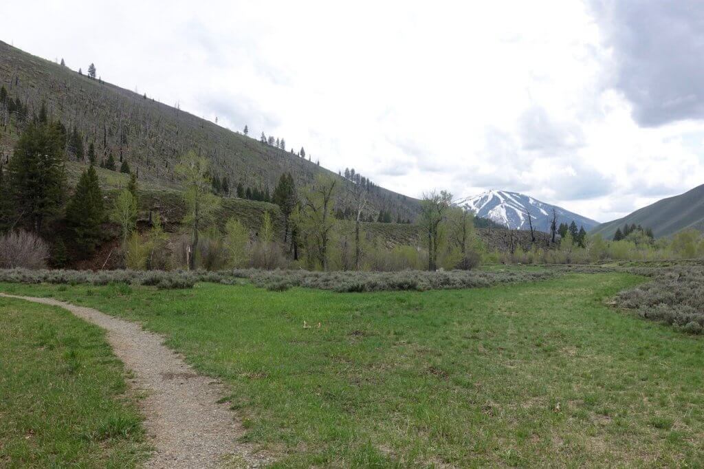
Trailhead Directions: From downtown Ketchum, go east on Sun Valley Road for 4.0 miles to the signed trailhead on the right (south) side of the road. You will pass the Hemingway Memorial at 2.8 miles and the Boundary Creek Campground at 3.8 miles. There is another parking area at 3.9 miles, but make sure to park at the 2nd parking area
Whether you are seeking an easy saunter, a chance to indulge in the therapeutic effects of nature, or a simple picnic in the woods, these accessible trails will certainly fill these desires. So, get your gear ready and go discover the great outdoor scenery of central Idaho!
Feature image credited to Scott Marchant.
Scott Marchant lives in Boise and when not exploring the rugged diversity of Idaho, he strives to keep up with his active family. After exploring thousands of miles of trails Scott published several hiking guidebooks and hopes that others will see these remarkable places and then help to preserve and protect our public lands. Read more about Scott’s story here..
More From This Author
Where to Hike Near Coeur d’Alene
Updated on July 05, 2023
Published on June 13, 2023
