Melynda Harrison worked in partnership with Visit Idaho to create this travel tip.
Road trips are the epitome of summer family vacations. Pack up the car, hit the open road and let the family bonding begin. In my family, we like to have educational, recreational and digestible elements in our road trips, so we planned our three-day weekend road trip around four of Idaho’s scenic byways where we could hit all of those elements.

Teton Overlook along Mesa Falls Scenic Byways. Photo credit: Melynda Harrison.
This big loop through eastern Idaho can start and end in Teton Valley, Rexburg or Island Park—just modify it as needed. We started in Island Park and followed the Mesa Falls Scenic Byway, Teton Scenic Byway, Fort Henry Historic Byway and Lost Gold Trails Loop. Along the way, we visited historic sites, natural wonders, breweries and restaurants and kept the Grand Teton Range within sight nearly the entire time. When it was time to get out and move, we hiked, biked and kayaked.
To copy our route, spend one night in Island Park and another in the Teton Valley (Victor or Driggs). Alternatively, you could base camp in Teton Valley for two nights. Plan to be pretty self-sufficient, especially along the Fort Henry and Lost Gold Trails byways, as gas stations and restaurants are limited. You’ll find gas stations in Island Park, the Teton Valley, Rexburg and Dubois. Cell service is not available everywhere, so download a map or bring one with you.
Mesa Falls Scenic Byway
Length: 28.2 miles (45.4 km). Add 19 miles (30.6 km) to get back to the northern end of the byway near Island Park if you’re doing the loop.
Upper Mesa Falls is the highlight of the byway, but there are other delights along the way.
Wildflowers blanketed the meadows along the road as we drove to our first stop at Upper Mesa Falls. The 10-story waterfall crashing over solidified lava millions of years old does not disappoint. Wandering the boardwalk and stopping at viewing platforms, we felt the mist on our faces and ogled the amount of water thundering over the cliff.
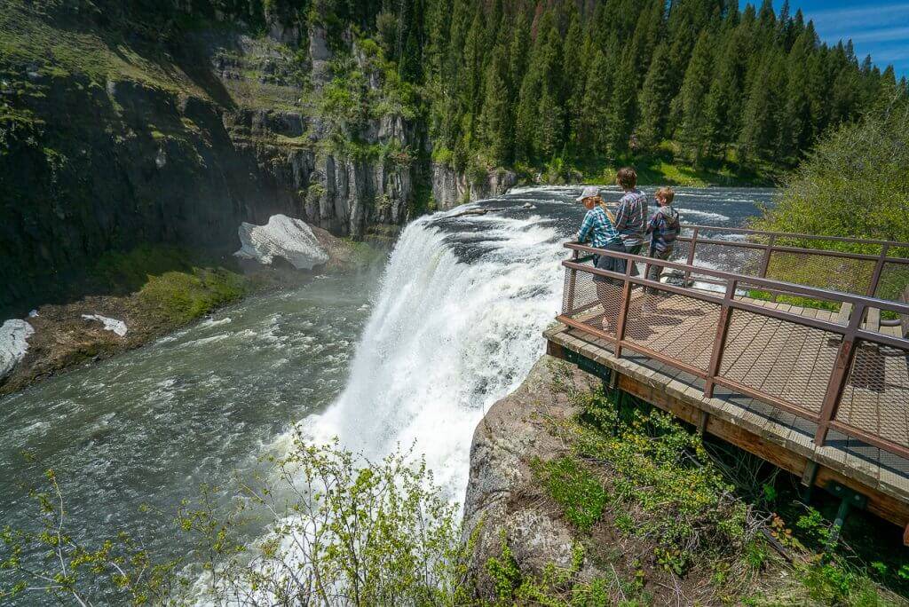
Mesa Falls near Ashton. Photo credit: Melynda Harrison.
Next, we stopped one mile south of Upper Mesa Falls at the Grandview Overlook to watch Lower Mesa Falls cascade down the canyon.
The Teton Overlook was our next stop on the Mesa Falls Scenic Byway. Though we could see the Grand Teton Range from other places in Island Park, this pullout perfectly framed the rocky peaks.
At the bottom of a windy hill, we pulled over in Idaho’s smallest town, Warm River (population: 3!), to feed gigantic trout at the Warm River feeding station and take a short walk on the Warm River Rail-Trail. The railroad bed-turned hiking and biking trail runs 30.9 miles from the Warm River Campground to Reas Pass on the Idaho-Montana border. We only walked a short distance on the trail but found it to be a very pretty walk. At three miles, there is an old railroad tunnel.

Grab a bite to eat at Frostop in Ashton. Photo credit: Melynda Harrison.
By the time we arrived in Ashton, we were ready for a treat and slurped milkshakes at the Frostop, an iconic drive-in burger joint.
From Ashton, we turned north and made our next stop at Harriman State Park to amble along the nature trails and do a little bird watching. We also wandered through the stables and put horseback riding on our list for our next visit.
We ended the day with dinner and cocktails on the deck at Last Chance Bar and Grill at TroutHunter Lodge. Families were playing in the grass and anglers cast for trout on Henry’s Fork while we supped.
Teton Scenic Byway
Length: 67.6 miles (109 km)
On the second day of our long weekend, we decided to make like a mountain man and rendezvous with epic views, recreational opportunities and yummy cuisine.
After spending the night at the Springhill Inn and Suites in Island Park, we drove back to Ashton and the northern terminus of the Teton Scenic Byway.

Wildflowers along the Teton Scenic Byway. Photo credit: Melynda Harrison.
The road starts in the Upper Snake River Valley. Driving through the rolling hills with the Grand Teton Range as an almost constant backdrop, we checked out the idyllic fields that make this the “Seed Potato Capital of the World.”
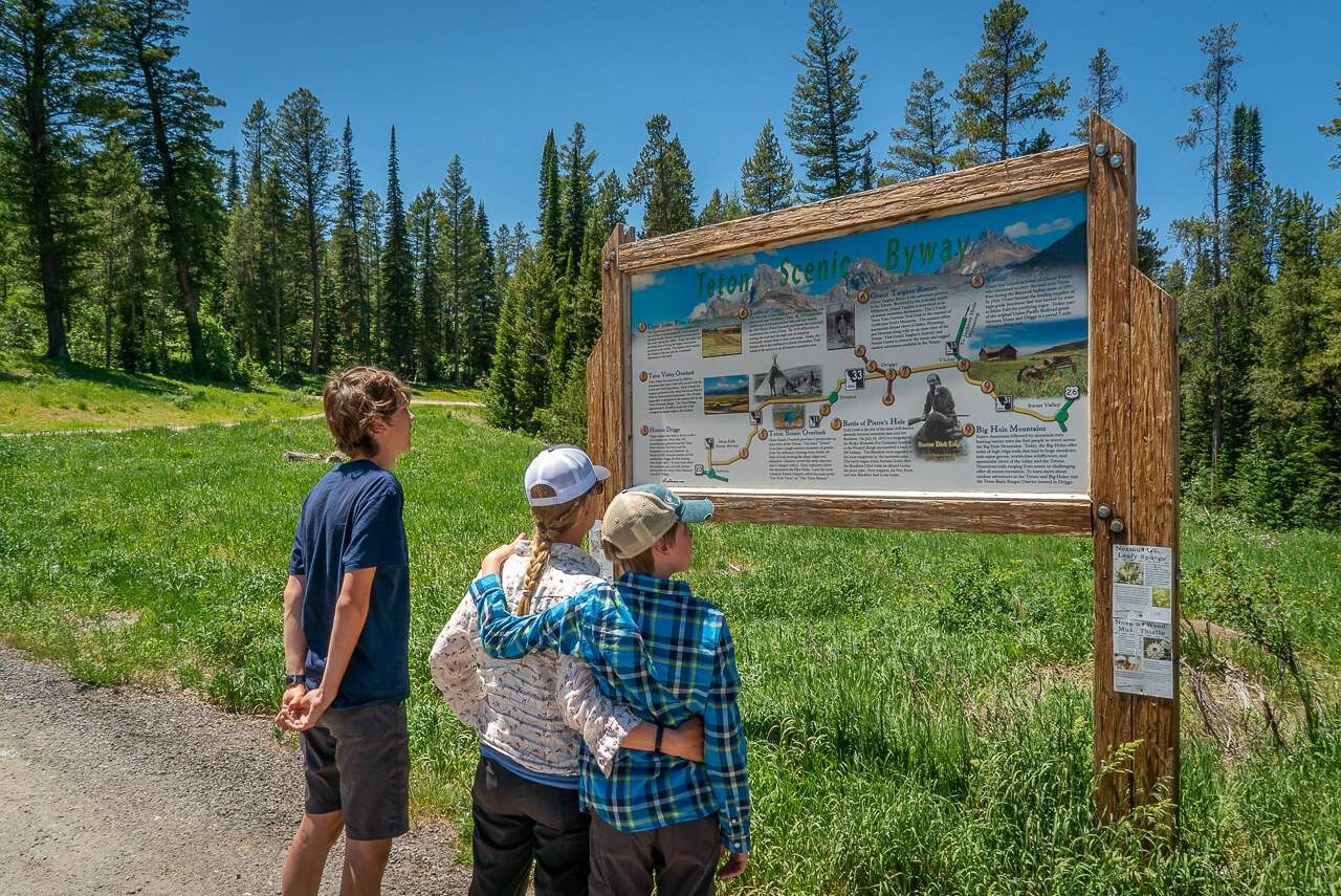
At Pierre’s Hole, we tried to picture the rendezvous where fur trappers and local tribes gathered to sell furs, resupply and enjoy a social occasion. In 1832, the largest rendezvous in the country was held here. An interpretive sign provides some information.
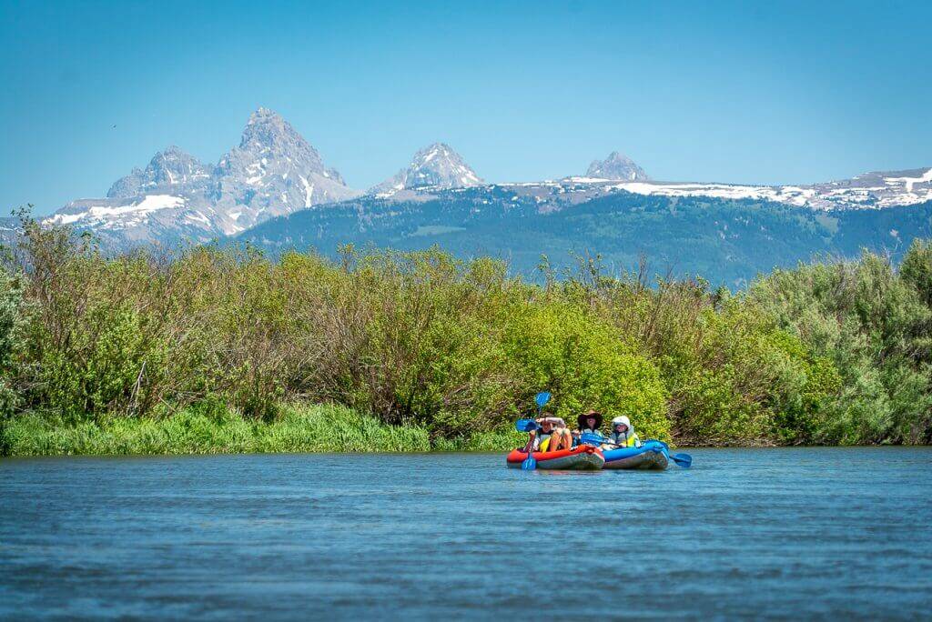
Try a scenic float on the Teton River. Photo credit: Melynda Harrison.
In the town of Driggs, we picked up lunch and inflatable kayaks for an easy paddle on the Teton River. We rented the boats from Teton River Supply and they shuttled us to the river and picked us up when we were done.
During our lazy two-hour paddle, we saw a moose mom and calf plus another solo moose, lots of birds and four otters. If that wasn’t enough, the Tetons were in our view the whole time.
Still buzzing from our kayaking outing, we checked into the Cobblestone Hotel in Victor and walked across the street to the Knotty Pine for dinner on the patio. Since you can’t go to the Teton Valley without getting a huckleberry shake, we ended our day with a walk down to the Victor Emporium and filled our bellies with local berries and ice cream.

Fort Henry Historic Byway and Lost Gold Trails Loop
Length: 90.4 miles (145 km) and 52 miles (83.6 km). 142.4 miles (228.6 km) if you combine the two byways in one trip.
After a quick walk through the arrowleaf balsamroot flowers at Pine Creek Pass and a short drive, we arrived in Swan Valley. From there, it was a quick jaunt to Rexburg and the start of the next two byways.
With a full tank of gas and picnic lunch in the cooler, we started the Fort Henry Historic Byway and Lost Gold Trails Loops at the big sign at the Old Fort Henry Site. The landscape ranges from sagebrush steppe to aspen-covered hillsides to Douglas fir forests and high mountain peaks.
The Fort Henry Monument commemorates the first American settlement west of the Rocky Mountains. Andrew Henry’s Missouri Fur Company post lasted only one brutal winter here.
We weren’t sure what to expect at the next destination, a historic beet slicer. This private interpretive site tells the story of the Fremont County Sugar Company’s slicer plant where they’d extract sugar from beets. The old rock ruins are interesting and we really appreciated the plantings that make it a nice garden stop.
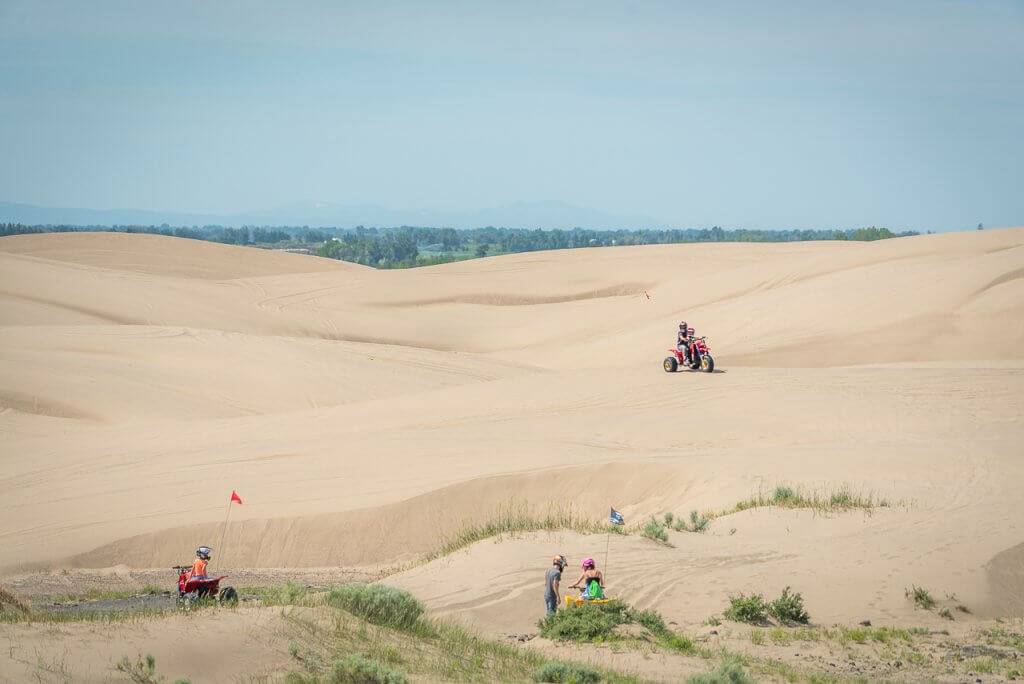
St. Anthony Sand Dunes. Photo credit: Melynda Harrison.
At the St. Anthony Sand Dunes, buggies, ATVs and UTVs zip over the white sand dunes. We didn’t walk very far, as the motorized vehicles could not see us over and between the dunes, but we did climb one close to the road where we got a stellar view of the Grand Teton Range.
In Dubois, we stopped at the gothic revival-style church turned museum and the large gas station the locals call the “mini-mall.” This is a good place to stock up on drinks, food, and gifts before getting back on the Lost Gold Trails Loop and heading north to Spencer.
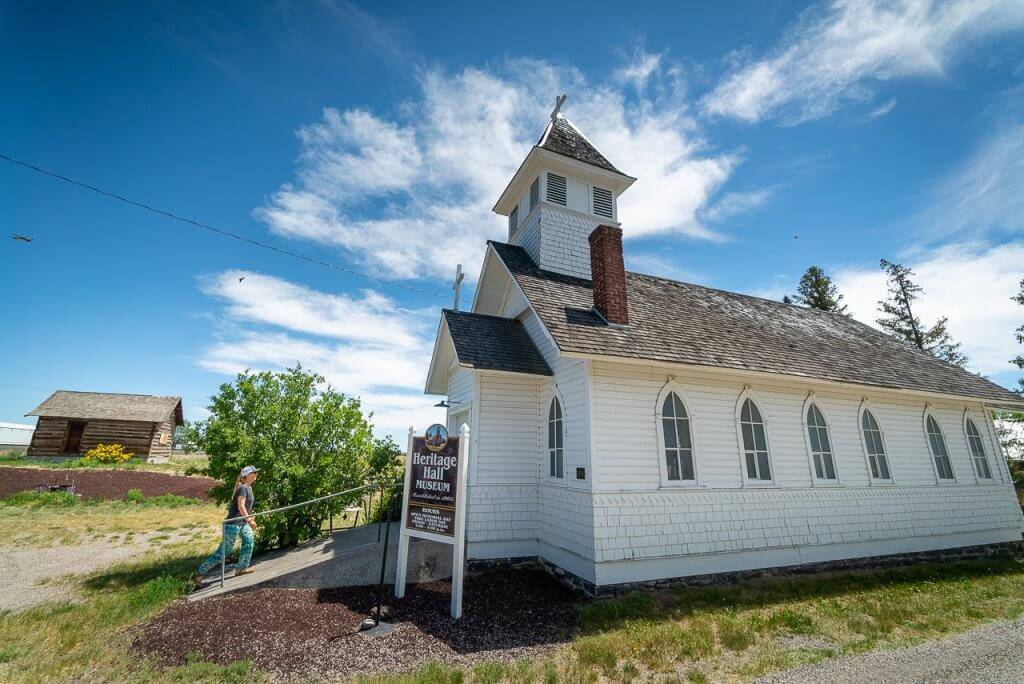
Heritage Hall Museum, Dubois. Photo credit: Melynda Harrison.
Spencer has three opal mines and is considered the “Opal Capital of America.” Purchase fine opals and opal jewelry in the gift shops.
Between Spencer and Kilgore, keep an eye out for hawks; we saw six!
Our final stop before reaching Island Park was at Camas Meadows. This site recognizes the Nez Perce Flight of 1877. An interpretive kiosk shares the story of a skirmish that took place in this meadow. Camas Meadows is an affiliated site of the Nez Perce National Historical Park. We were especially moved by the silhouettes of three warriors on horseback.
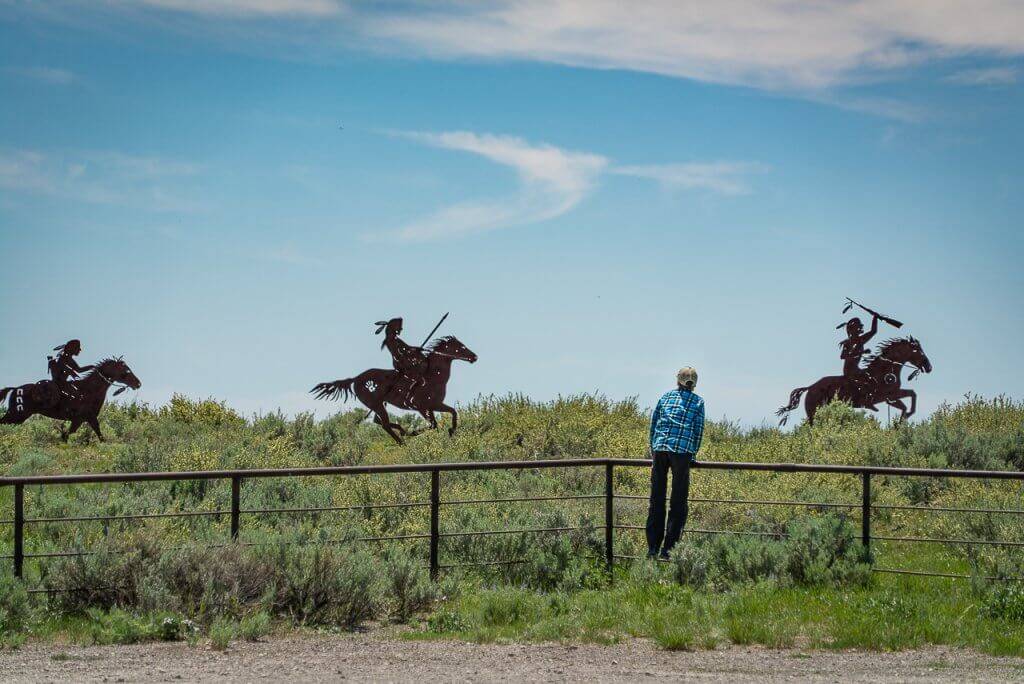
Camas Meadows Battle Sites near Dubois. Photo credit: Melynda Harrison.
Back in Island Park, our three-day, four-byway trip was complete and we pointed the car toward home. During our long weekend of eating, learning and recreating, we felt like we knew this corner of Idaho a whole lot better.
Feature image credited to Melynda Harrison.
Melynda Harrison writes about travel and outdoor family adventure at TravelingMel.com, YellowstoneTrips.com, and many local and regional publications. When she’s not behind a laptop, you can find her cross-country skiing, hiking, or floating a river.
Updated on June 23, 2025
Published on August 31, 2021
