Scott Marchant worked in partnership with Visit Idaho to create this Travel Tip.
Idaho is a hiker’s paradise. Unknown to many, the state contains the nation’s largest designated wilderness outside of Alaska—the 2.3 million-acre Frank Church River of No Return Wilderness—and over 20 million acres of national forest. Some of the most beautiful and varied topography in the U.S. is found here, including the spectacular peaks of the Sawtooth Mountains, the lunar landscapes of Craters of the Moon, the rugged canyons of the Owyhee Canyonlands and the dense forests of Idaho’s Panhandle.
Whether you’re a novice hiker or a long-time veteran, you’ll find trails suited for every ability. Below, I’ve listed a diverse selection of hikes, ranging from a lengthy and challenging backpack in Hells Canyon to a short hike along the winding Crooked River. So, lace up your boots and prepare to be awe-struck by the unforgettable scenery of the rough-hewn landscape of Idaho.
Upper Hazard and Hard Creek Lakes
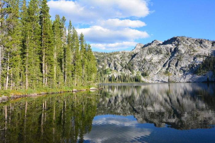
About 20 minutes north of Brundage Mountain Resort near McCall is a splendid hike exploring two high-alpine beauties—Upper Hazard and Hard Creek lakes. An easy hike, the trek offers flower-filled meadows, soaring granite peaks, solitude and the beautiful Upper Hazard Lake, flanked by the 8,607-foot Bruin Mountain.
The short hike to Upper Hazard Lake (3.8 miles out-and-back) and easy elevation gain (350 feet) makes this outing an outstanding choice for families. You can extend the hike to nearly five miles (out-and-back) by trekking to the smaller but equally impressive Hard Creek Lake. Other trailheads along Goose Lake Road provide access to Granite Mountain Lookout, Twin Lakes, the Grass Mountain Lakes and Hidden Lake.
Trailhead Directions: From downtown McCall, drive west 5.5 miles on State Highway 55. Turn right on Brundage Mountain—Goose Lake Road. Continue 21.5 miles (the road turns to improved gravel at 3.8 miles) and turn right toward the signed trailhead. Vault toilets, drinking water and overnight camping are available at the Hazard Campground, just north of the trailhead. The campground is located on the scenic Hazard Lake.
Snake River Trail in Hells Canyon
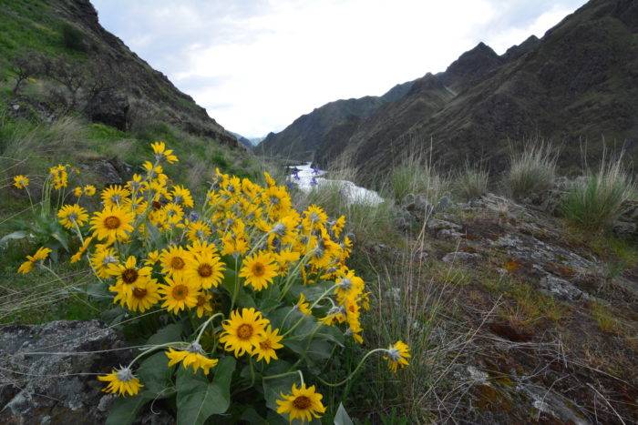
For one of the best canyon hikes in Idaho, look no further than the Snake River Trail in Hells Canyon. The long trail—nearly 27 miles one-way—allows users to mastermind out-and-back hikes of varying lengths. The scenery is spectacular as the river is always close and steep, with canyon walls soaring thousands of feet above the trail. The route is rarely flat—it winds up and down canyon walls and over rock outcroppings, sometimes dynamited several hundred feet above the river. The first mile of the hike is suited for families.
Spring is the best time to hike—wildflowers bloom, the canyon is green, seasonal creeks flow and the temperatures are mild. Fall is another nice alternative, but think twice in summer when temperatures soar. If you’re a history buff, be sure to visit the historic Kirkwood Ranch about six miles from the trailhead. The original ranch house from the 1930s is still intact, and the nearby Kirkwood Creek provides a beautiful riparian habitat to enjoy this scenic setting.
Trailhead Directions: The trailhead is located near Pittsburgh Landing, about 19 miles southwest of Highway 95, near White Bird. From Highway 95, go west on Old Highway 95 for about a mile, cross the bridge over the Salmon River and turn left on Deer Creek Road. Follow the dirt road 17 miles and turn left on Forest Road (FR) 493A, which leads 1.6 miles to the trailhead. There is a restroom and overnighters can stay at the nearby 28-campsite Pittsburgh Campground.
Alpine and Sawtooth Lakes

Be forewarned: After visiting the Alpine and Sawtooth lakes, you may never want to return home. This trek breathes Sawtooth Mountains—soaring peaks, wildflower meadows, towering conifer forests, crystal-clear creeks and cobalt-blue lakes all encircled in a geological world of granite. Families will find the scenic meadow near the Sawtooth Wilderness boundary (1.1 miles from the trailhead) to be an excellent destination.
It is 7.8 miles (out-and-back) and 1,300 feet of gain to reach Alpine Lake. From Alpine Lake, it is another mile and 600 feet of additional gain to see the 173-acre Sawtooth Lake. The lake is surrounded by soaring peaks, including Alpine Peak and the triangular Mt. Regan. Backpackers will find plenty of sites near Alpine Lake and limited spots near Sawtooth Lake.
Trailhead Directions: From Stanley, drive west on Highway 21 for 2.6 miles and turn left on the well-graded FR 619. Follow the road 3.2 miles to the Iron Creek Trailhead where there is a large parking area and vault toilet. Past the trailhead, you will find the Iron Creek Campground with ten sites.
Crooked River
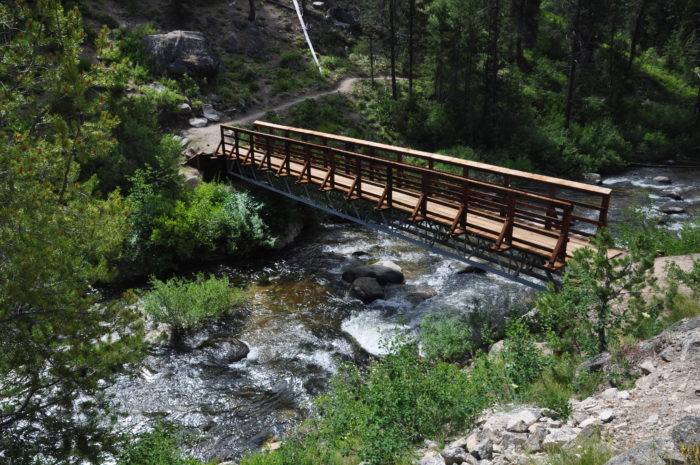
The Boise National Forest contains an abundance of excellent hiking trails and one of the better ones is the Crooked River, north of Idaho City. The trail is well-maintained for the first five miles as it follows the river downstream and leads to a multitude of fine destinations. Mature forest, sandy beaches, rock outcrops and steep canyon walls all add to the hike’s appeal.
Families can hike to the bridge spanning the Crooked River at 1.3 miles. The trail is generally flat and the bridge makes for a great destination. Fishing is excellent for cutthroat, brook and rainbow trout. The trail is generally accessible from the end of May until November.
Trailhead Directions: From Idaho City, drive north on Highway 21 for 17.5 miles and turn right on FR 384. Drive 1.1 miles on the well-graded dirt road to the signed trailhead on the south side of the road. There is no restroom, but one can be found at the Edna Creek Campground at the intersection of FR 384 and Highway 21.
Craters of the Moon National Monument and Preserve
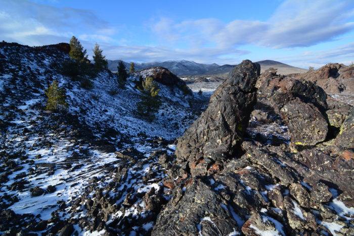
An early visitor to Craters of the Moon National Monument & Preserve may have described the area best: “The strangest 75 square miles on the North American continent.” Craters of the Moon is a collection of lava flow fields adorned with cinder and spatter cones, lava tubes and volcanic fissures. Hike the North Crater Trail (3.5 miles out-and-back) to see many of these geological features. Although late spring and early summer provide wildflowers and optimal temperatures, winter offers solitude and snowshoeing opportunities.
Trailhead Directions: The main entrance to Craters of the Moon is 18 miles southwest of Arco or 24 miles northeast of Carey, along Highway 20. Once in the park, continue past the visitor’s center about a mile to the trailhead (located on the west side of the road).
All photos, including the feature photo, are credited to Scott Marchant.
Scott Marchant lives in Boise and when not exploring the rugged diversity of Idaho, he strives to keep up with his active family. After exploring thousands of miles of trails Scott published several hiking guidebooks and hopes that others will see these remarkable places and then help to preserve and protect our public lands. Find more hiking trail details from Scott here.
Updated on April 20, 2023
Published on April 28, 2020
